【Video】hanges for 130 years of Sakae zone in Nagoya city
- Return to INDEX
- ①400 Years of Nagoya History
- ②History of Nagoya Castle 400 years
- ③Changes for 130 years of Nagoya station
- ④Changes for 400 years of Sakae zone in Nagoya city
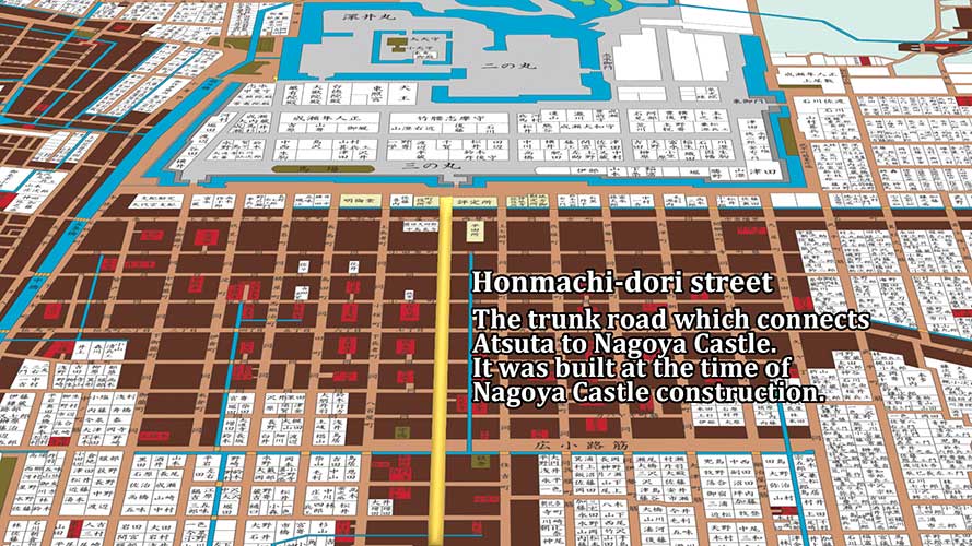
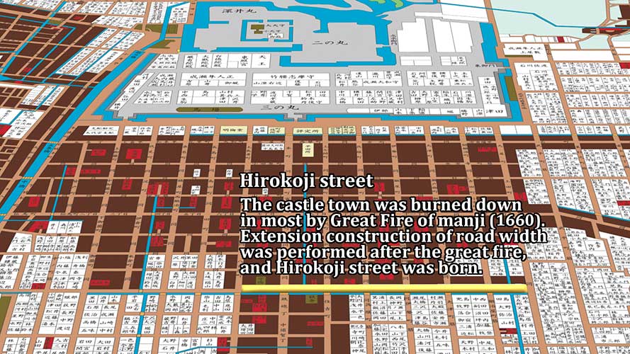
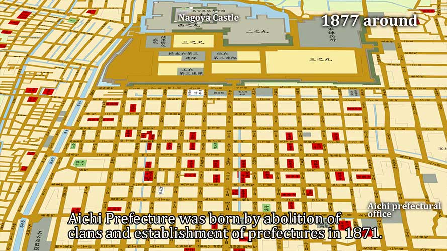
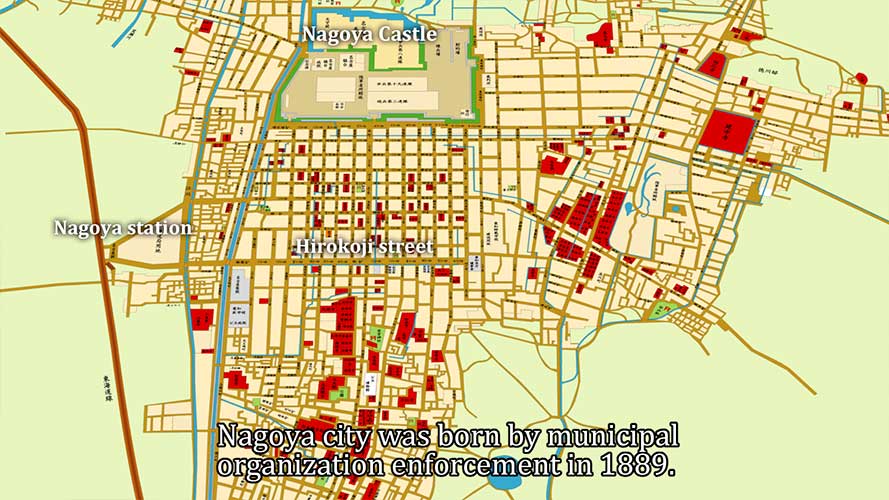
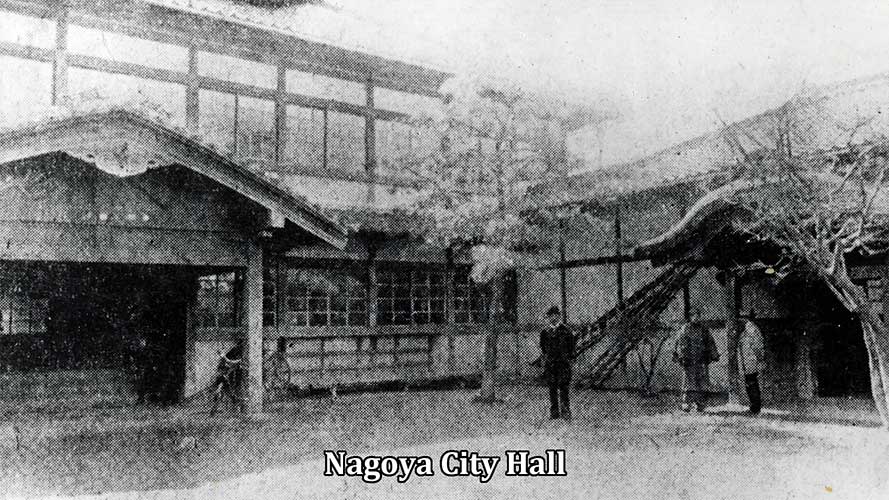
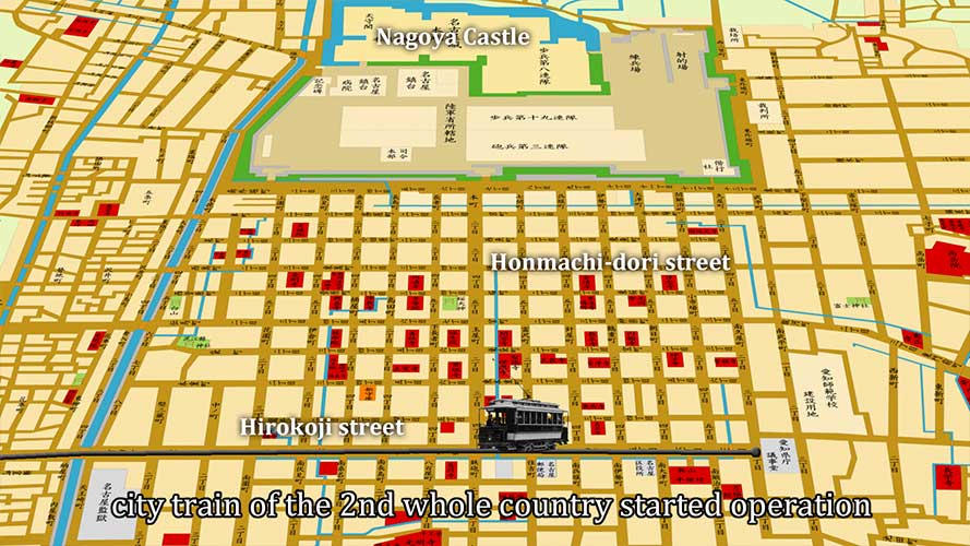
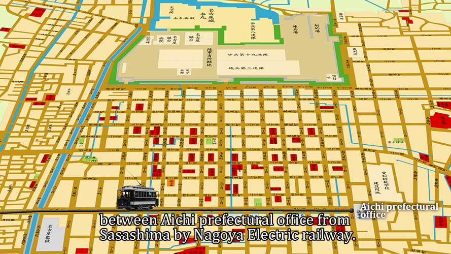
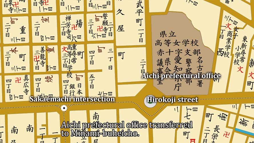
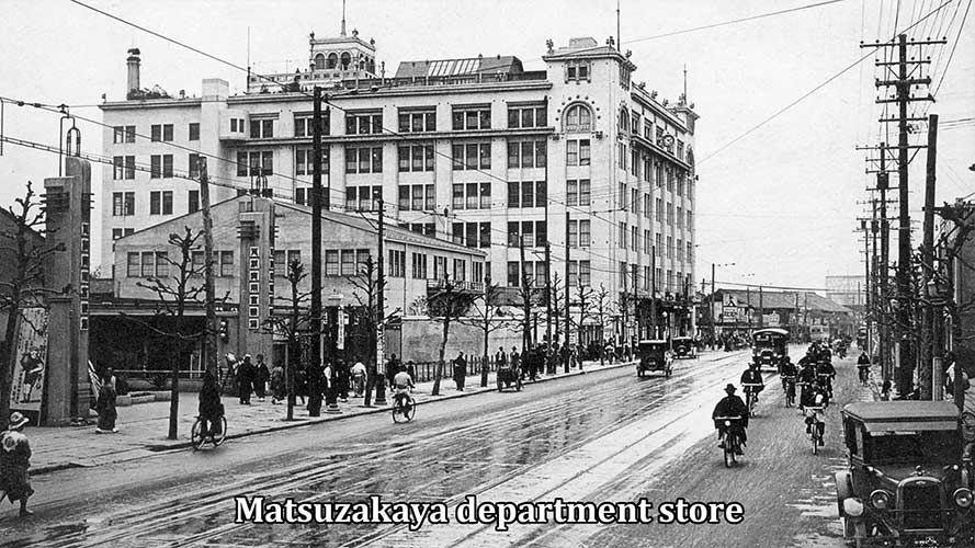
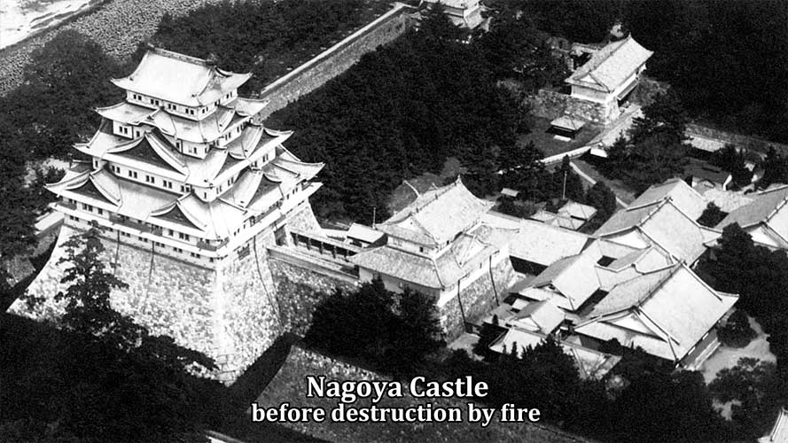
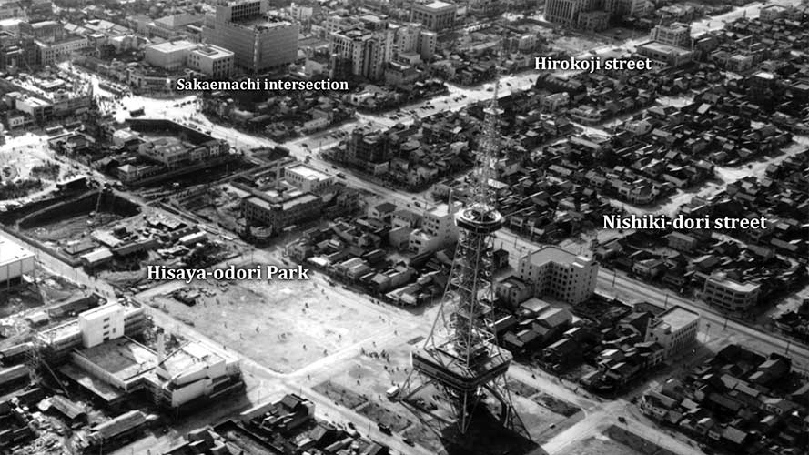
Nagoya Castle and the castle town were built about 400 years ago, in the early 1600s, on the Nagoya plateau.Until the middle of the Meiji era (1868-1912), the central part of Nagoya was located along Honmachi-dori street, south of Nagoya Castle.In 1889, Nagoya City was founded and the city hall was located south of Hirokoji street in Sakae-machi (now Sakae Crossing).In 1887, Nagoya Station was opened in Sasajima, and in 1898, Japan's second streetcar service opened between Sakae-machi and Nagoya Station, following Kyoto.Later, Hirokoji-dori was extended to the east, and the Aichi Prefectural Office, which was located at the eastern terminus of Hirokoji-dori, was moved to the north.In 1907, Nagoya City Hall was destroyed by fire, and Nagoya's first department store was built on the site.Nagoya City Hall was moved to the present location in 1933, followed by the Aichi Prefectural Government in 1938, and the Sakae-machi area developed into the largest commercial district in Nagoya.Nagoya Castle was destroyed by fire on May 14, 1945, at the end of the Pacific War. The center of Nagoya City was burnt to the ground.Post-war reconstruction began in the Sakae-machi district. The Nagoya TV Tower opened in 1954, and the Higashiyama subway line between Sakae-machi and Nagoya Station opened in 1957.In addition, the first large-scale underground shopping mall in Japan was built, and it has been gradually expanded since then.The redevelopment project of Hisaya Odori Park began in January 2019 and was completed in September 2020.
Map
Changes for 130 years of Sakae zone in Nagoya city
-
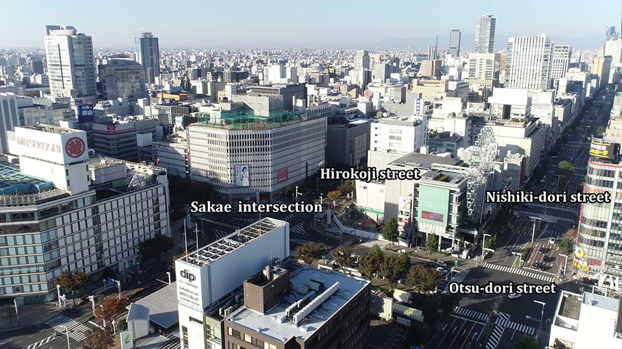
Sakae intersection
-
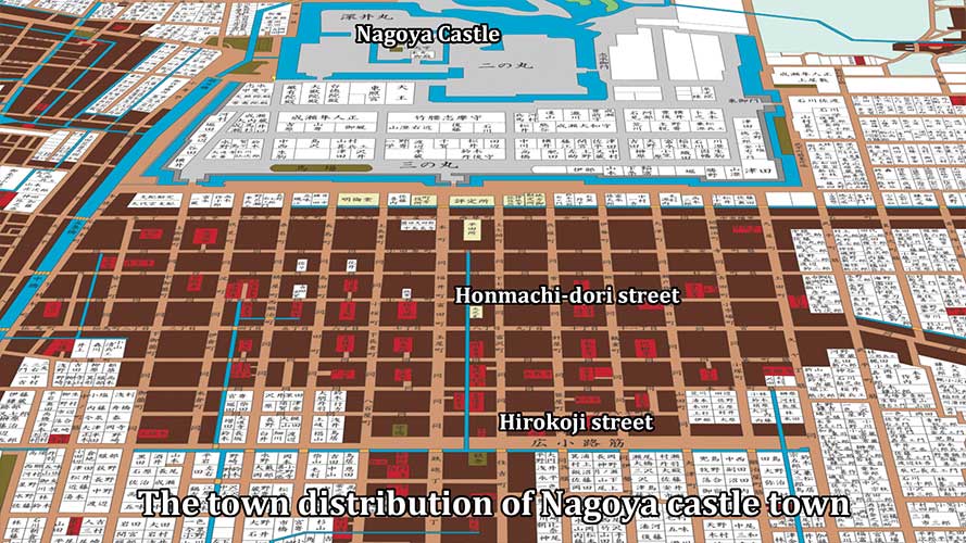
The town distribution of Nagoya
-
The town distribution of Nagoya
-
The town distribution of Nagoya
-

The town distribution of Nagoya
-
1877 around Map
-

Aichi prefectural office 1877
-
Nagoya city Map 1889
-

Nagoya city Map 1889
-
Nagoya City Hall 1889
-
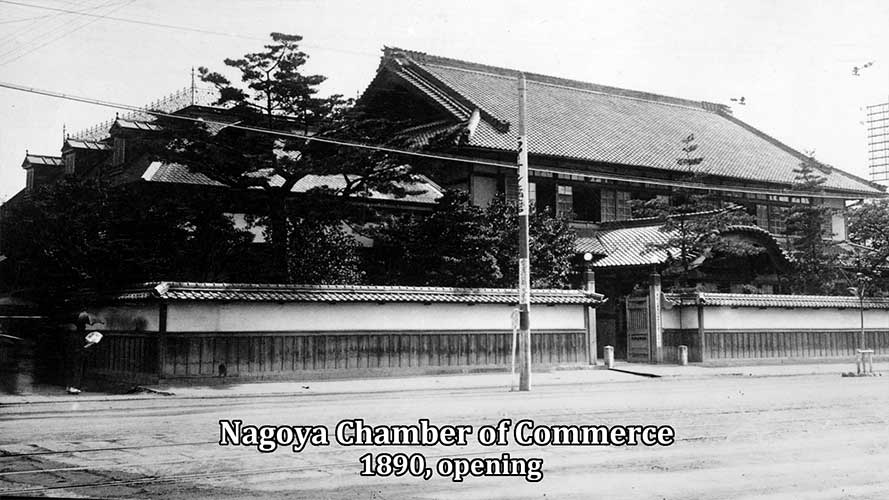
Nagoya Chamber of Commerce
-

Bank of Japan Nagoya Branch
-
Nagoya city Map 1890 around
-
Nagoya city Map 1890 around
-
Map 1905 around
-
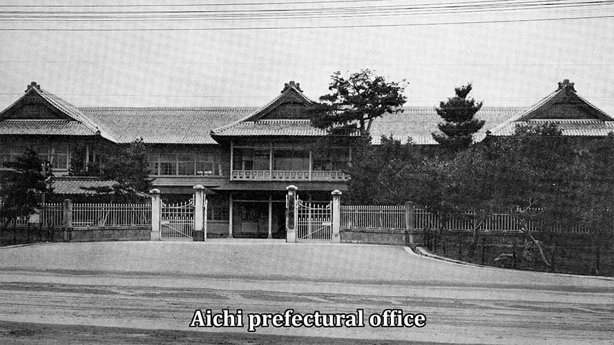
Aichi prefectural office 1905
-
1905 around
-
1905 around
-

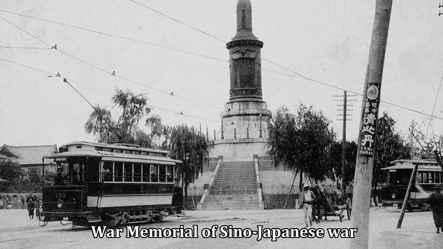
Nagoya Port Open 1907
-
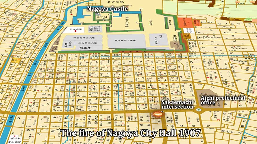
The fire of Nagoya City Hall
-
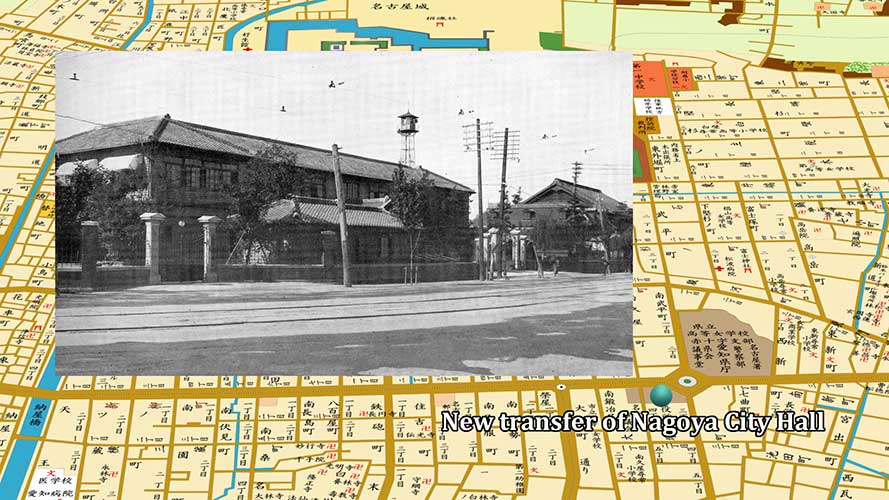
New transfer of Nagoya City Hall
-
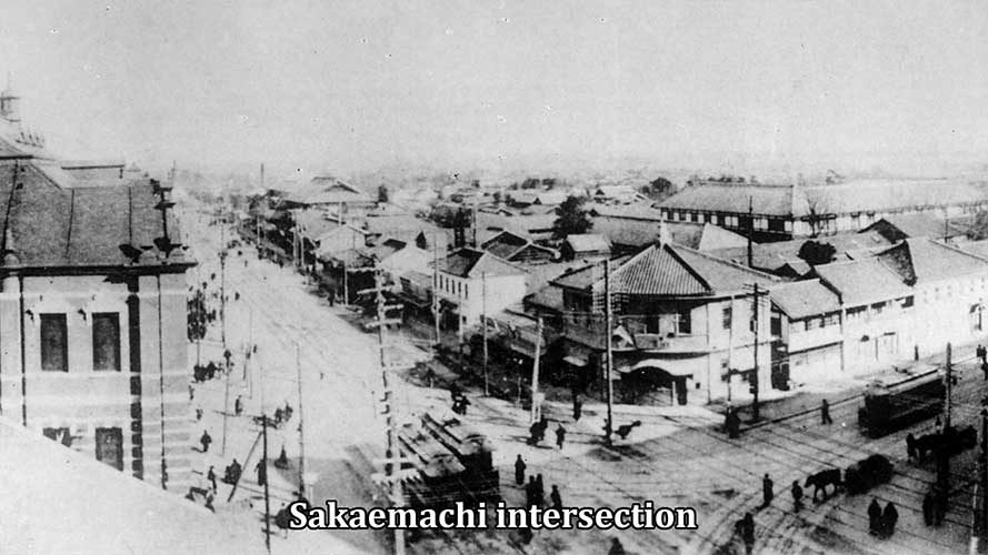
Sakaemachi intersection 1911
-
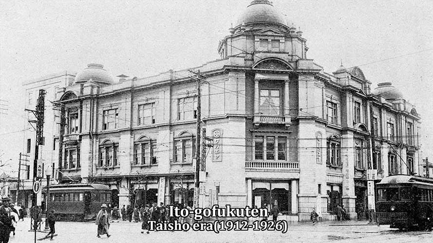
Ito-gofukuten 1915 around
-
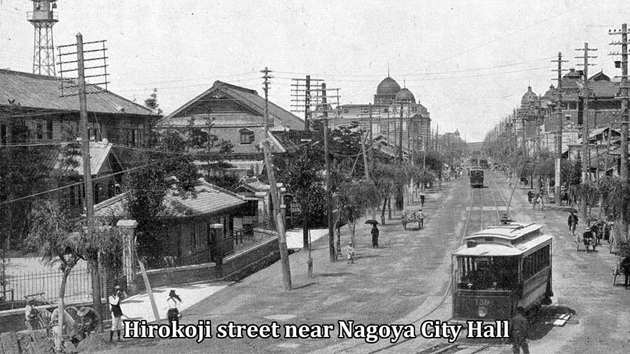
Hirokoji street 1915 around
-
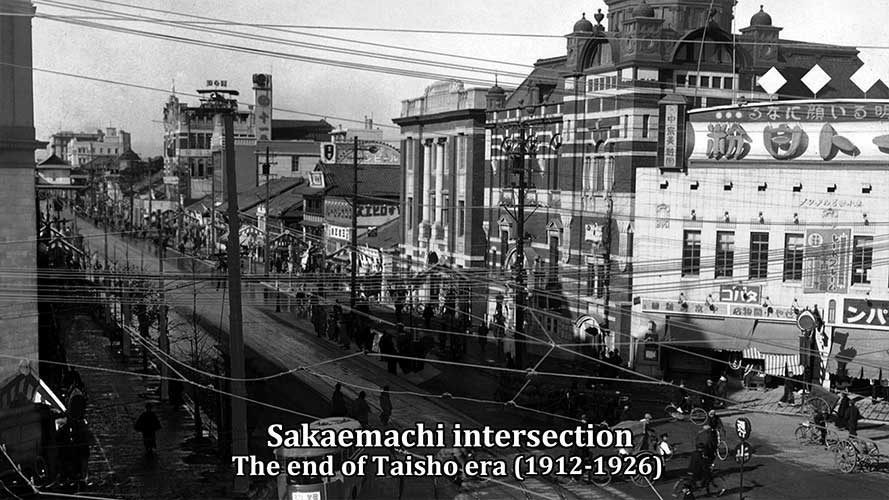
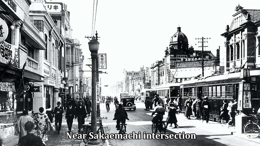
Sakaemachi intersection 1925 around
-
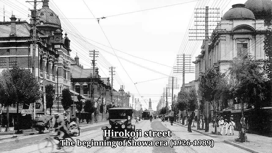
Hirokoji street 1930 around
-

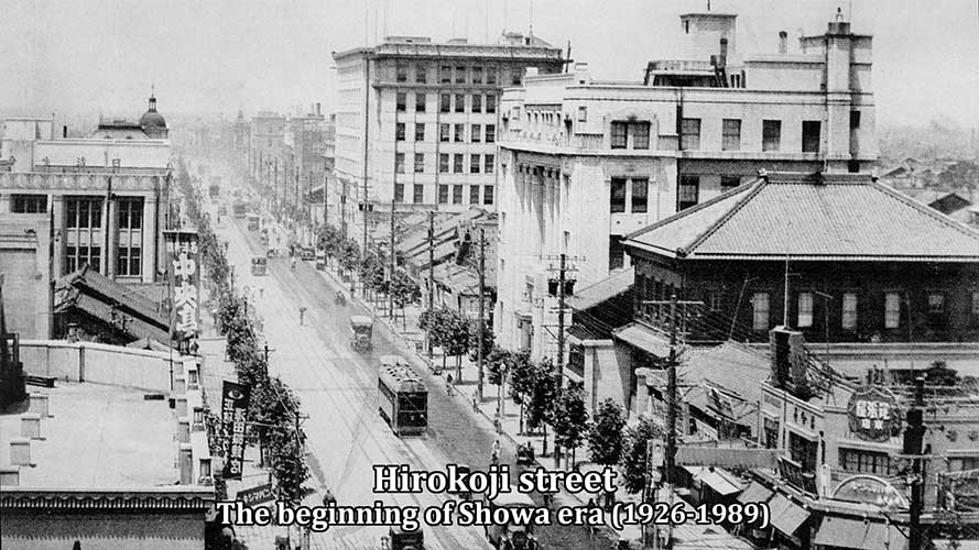
Hirokoji street 1930 around
-
Hirokoji street 1930 around
-
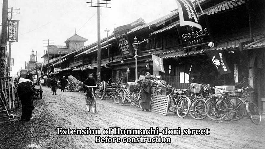
-Honmachi-dori street 1925
-
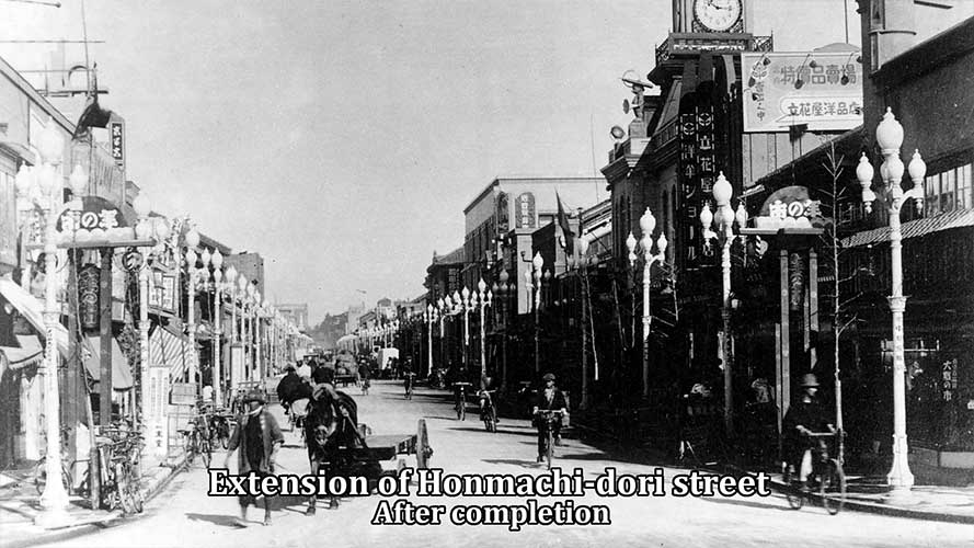
Honmachi-dori street 1933 around
-
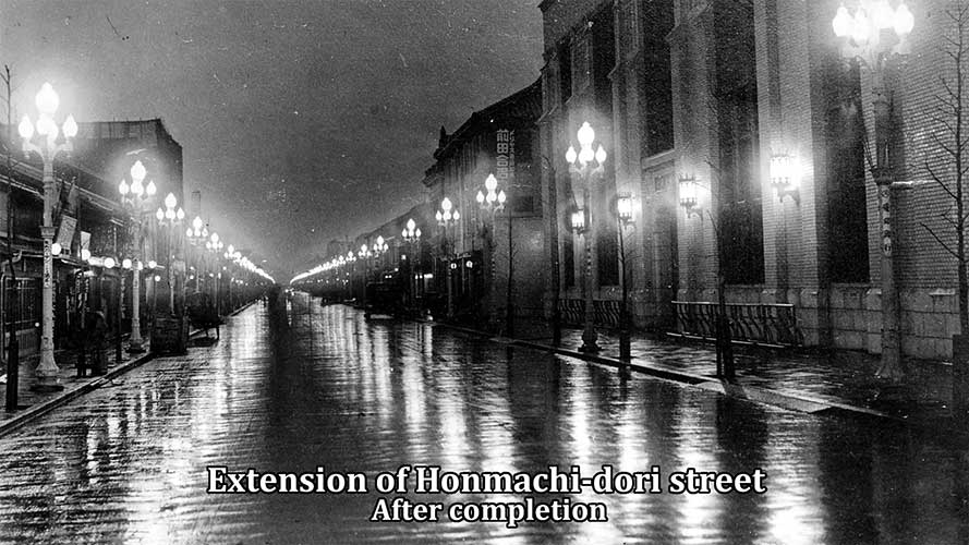
Honmachi-dori street 1933 around
-
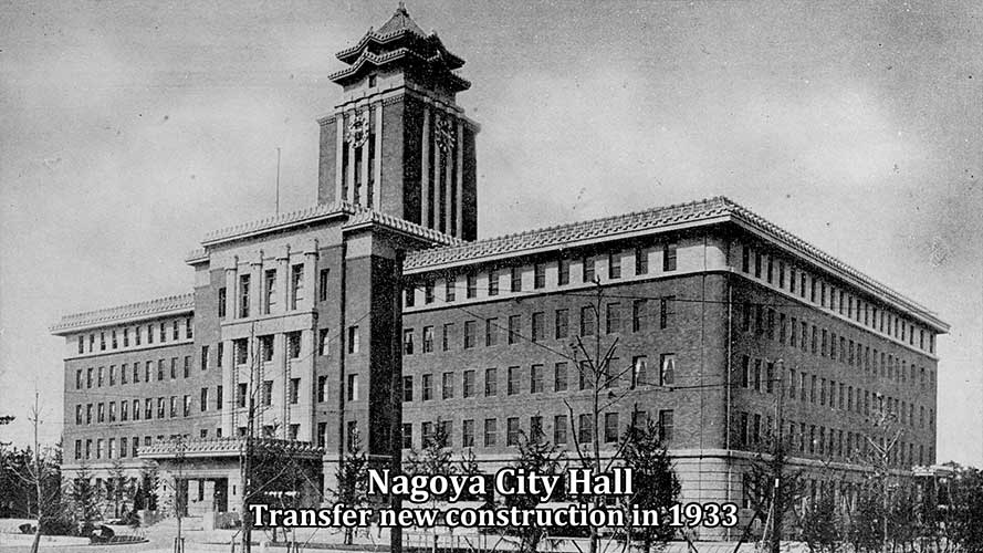
Nagoya City Hall 1933
-
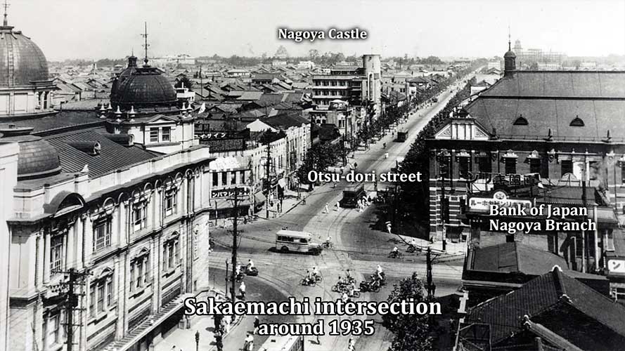
Sakaemachi intersection 1935 around
-

Sakaemachi intersection 1935 around
-
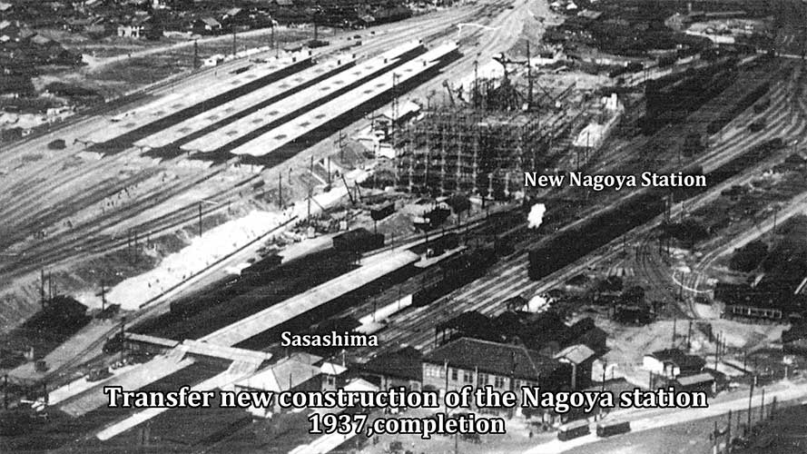
New construction of Nagoya station
-
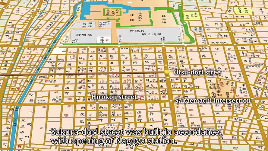
The construction of Sakura-dori
-

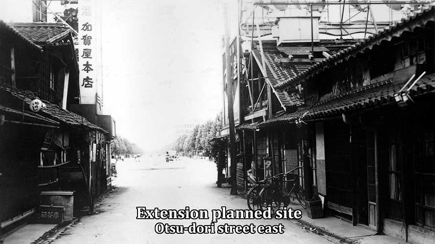
Otsu-dori street 1937 around
-
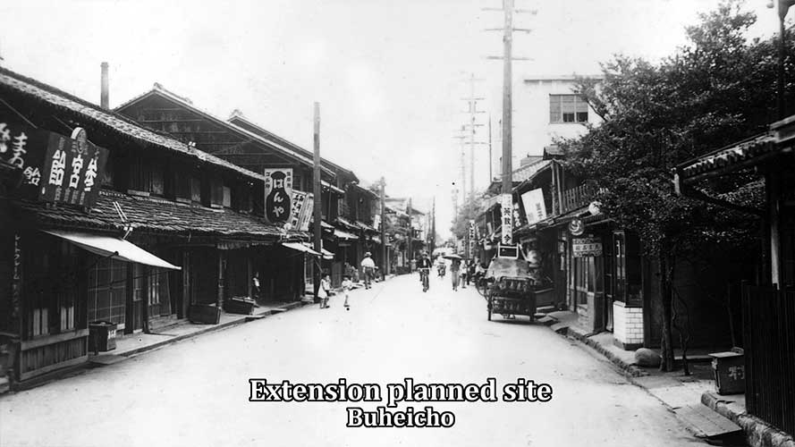
1937 around
-
1937 around
-
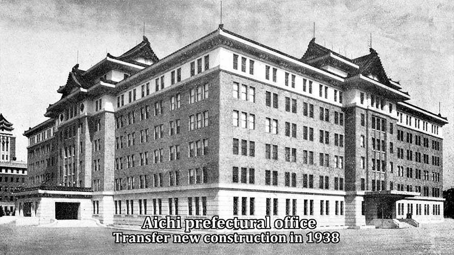
Aichi prefectural office 1938
-
1940 around
-

1940 around
-
1940 around
-
1940 around
-
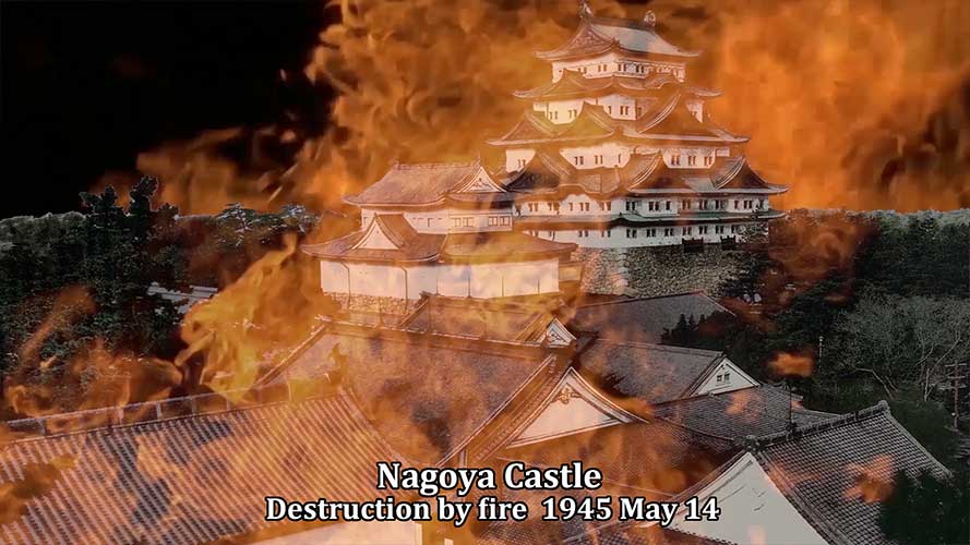
Flames of Nagoya castle 1945
-

akae zone 1946 around
-

akae zone 1946 around
-
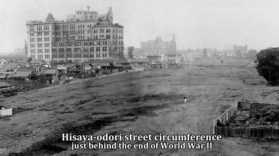
akae zone 1946 around
-
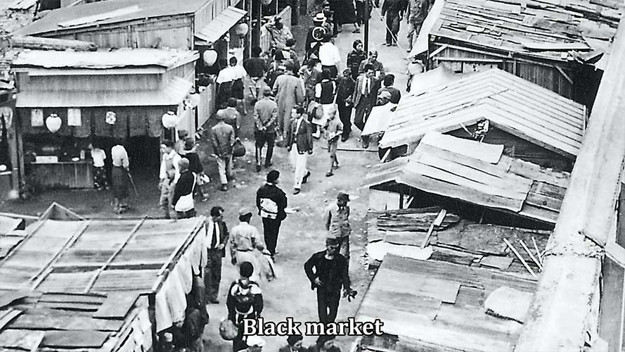
akae zone 1946 around
-
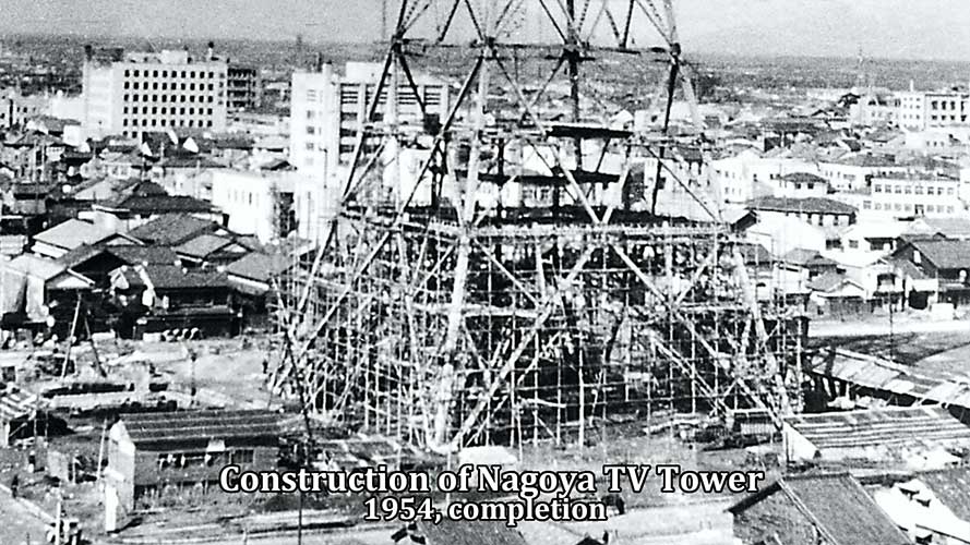
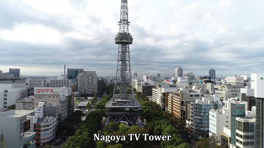
Construction of Nagoya TV Tower
-
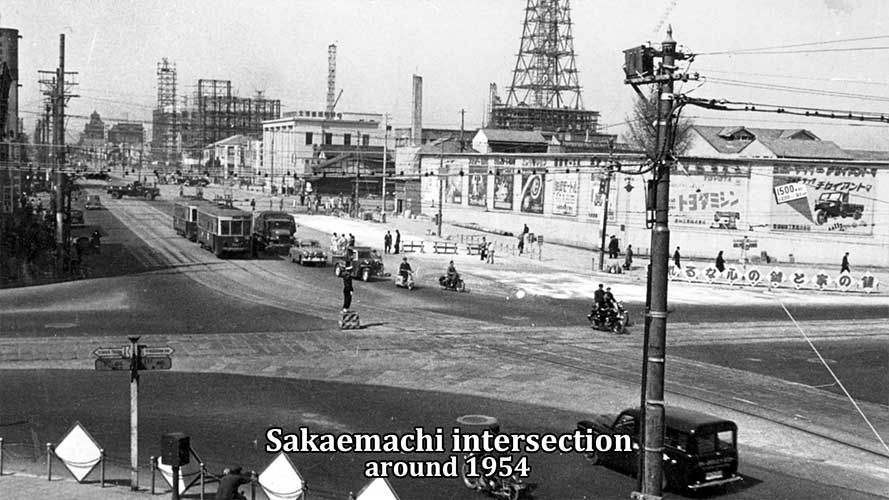
Sakaemachi intersection 1953 around
-
Nagoya TV Tower 1955 around
-
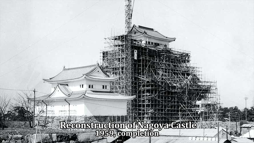
Reconstruction of Nagoya Castle
-
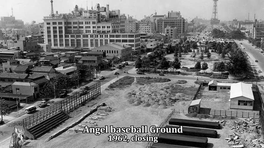
Hisaya-odori Park 1962 around
-
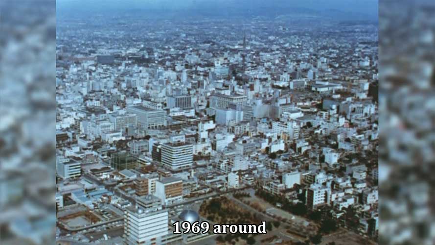
Sakae zone 1969 around
-
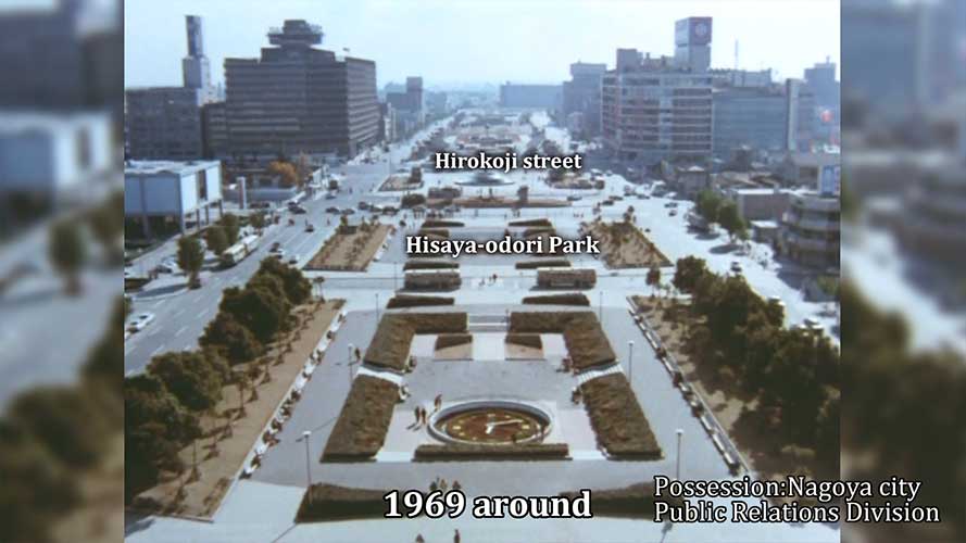
Hisaya-odori Park 1969 around
-
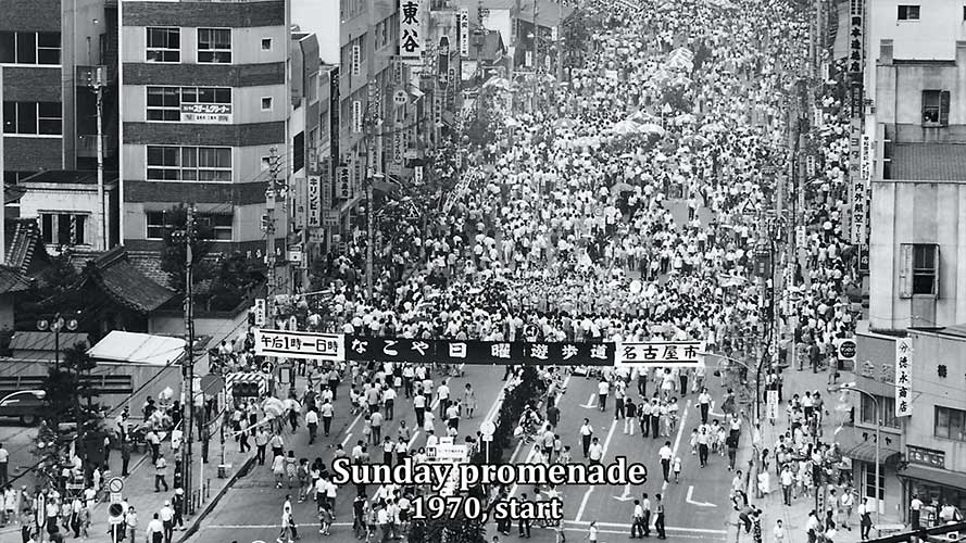
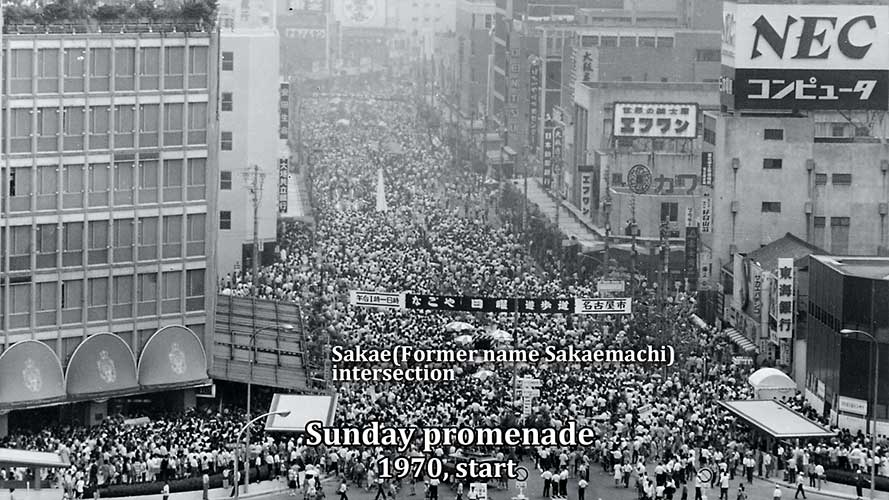
Sunday promenade 1975 around
-
Sunday promenade 1975 around
-

1979 around
-
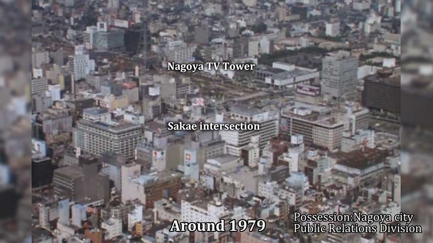
Sakae zone 1979 around
-
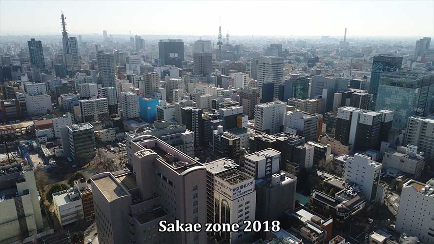
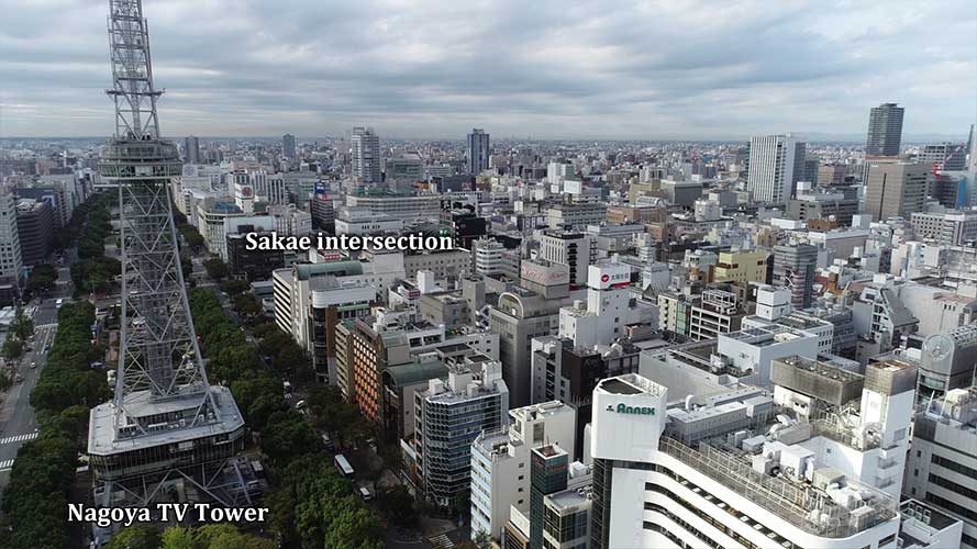
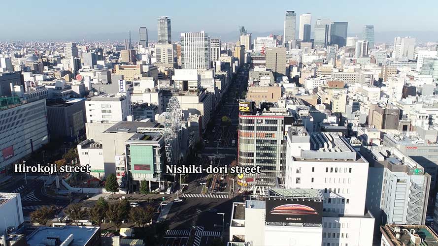
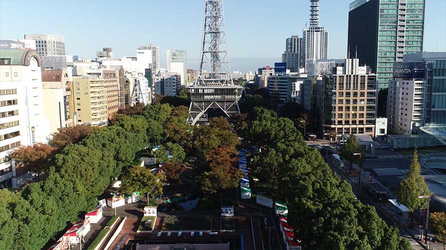
Sakae zone 2018
-
Sakae zone 2018
-
Sakae zone 2018
-
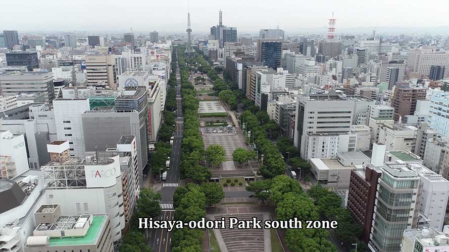
Sakae zone 2018
-
Sakae zone 2018
-
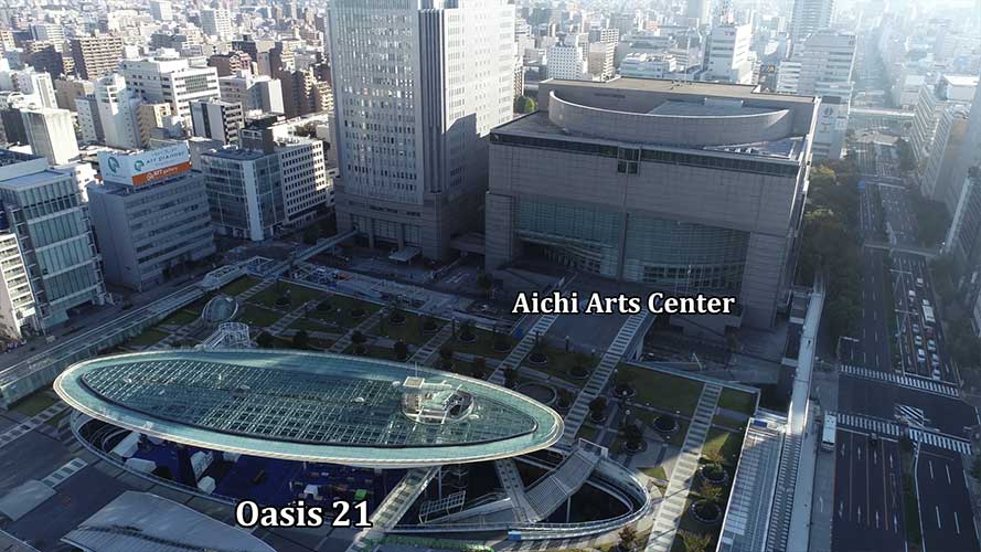
Oasis 21
-
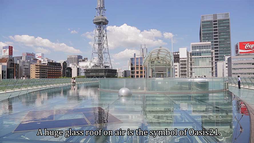
Oasis 21
-

Oasis 21
-
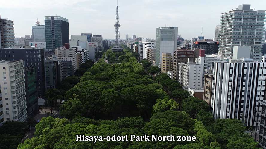
Hisaya-odori Park North zone
-
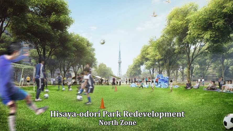
Redevelopment 2020
-
Redevelopment 2020
-
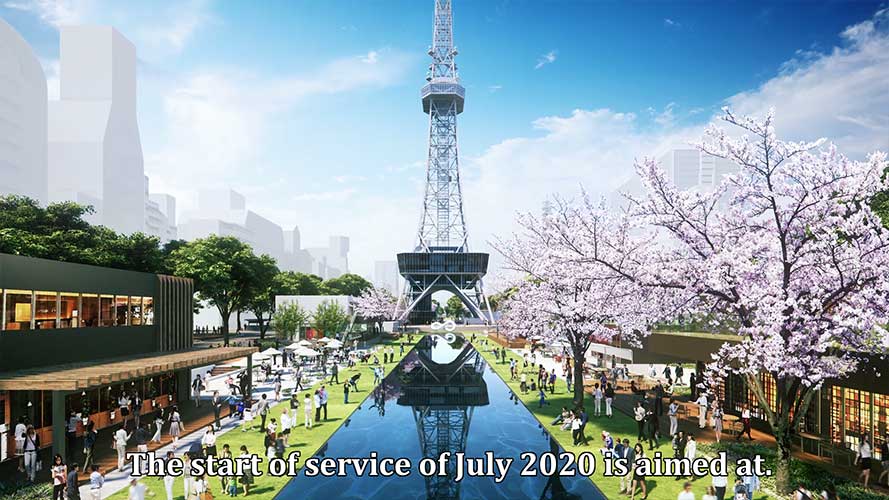
Redevelopment 2020