【Video】400 Years of Nagoya History
- Return to INDEX
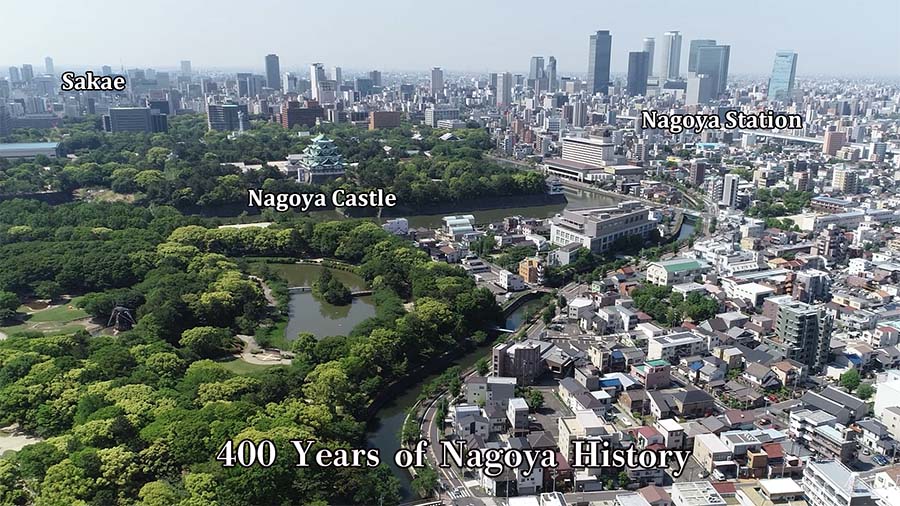
- ①400 Years of Nagoya History
- ②History of Nagoya Castle 400 years
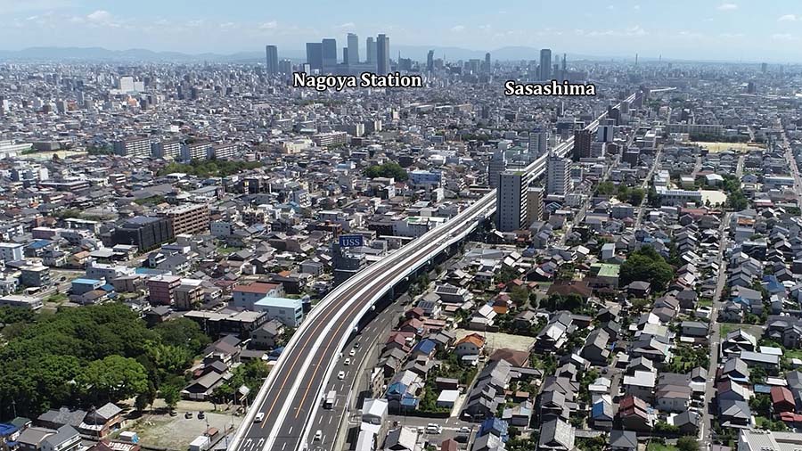
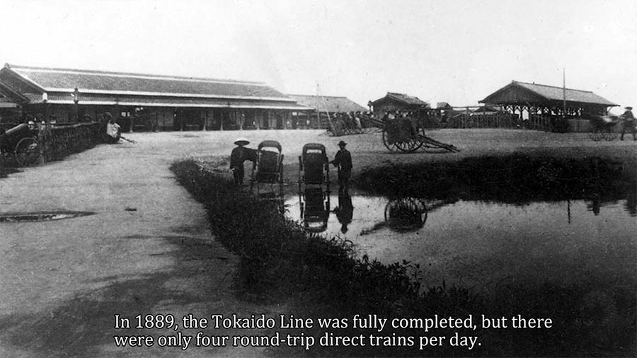
- ③Changes for 130 years of Nagoya station
- ④Changes for 400 years of Sakae zone in Nagoya city
Birth of Nagoya Castle Town
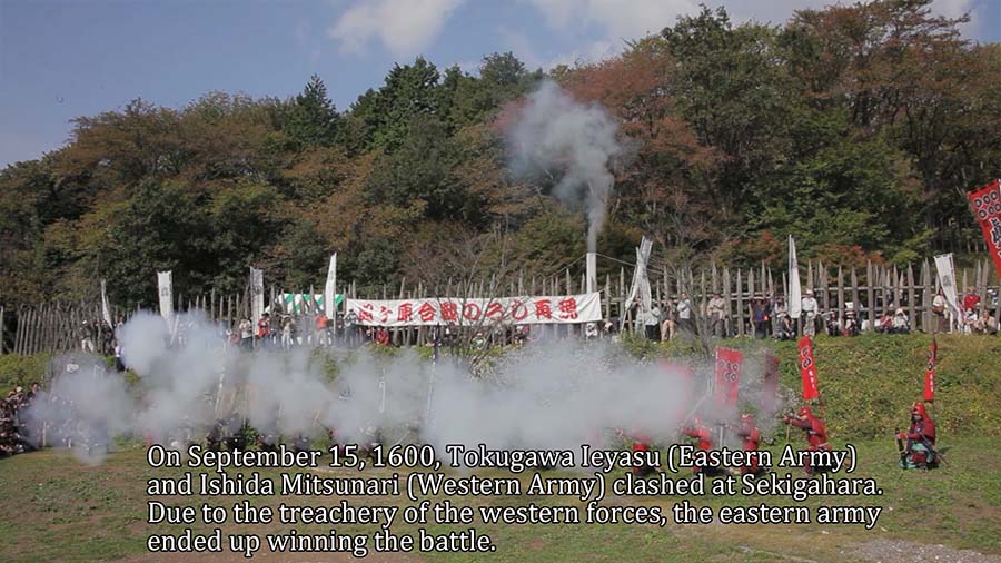
Keicho 5, September 15, 1600 AD, The Eastern Army led by Tokugawa Ieyasu and the Western Army led by Ishida Mitsunari clashed at Sekigahara.After a long period of deadlock, in the afternoon Kobayakawa Hideaki and others turned to the eastern forces. The situation of the war tilted heavily in favor of the eastern forces and ended in their victory.Kiyosu Castle Town was called the heavyweight of the Kanto region and was a large city at the time with a population of over 60,000.
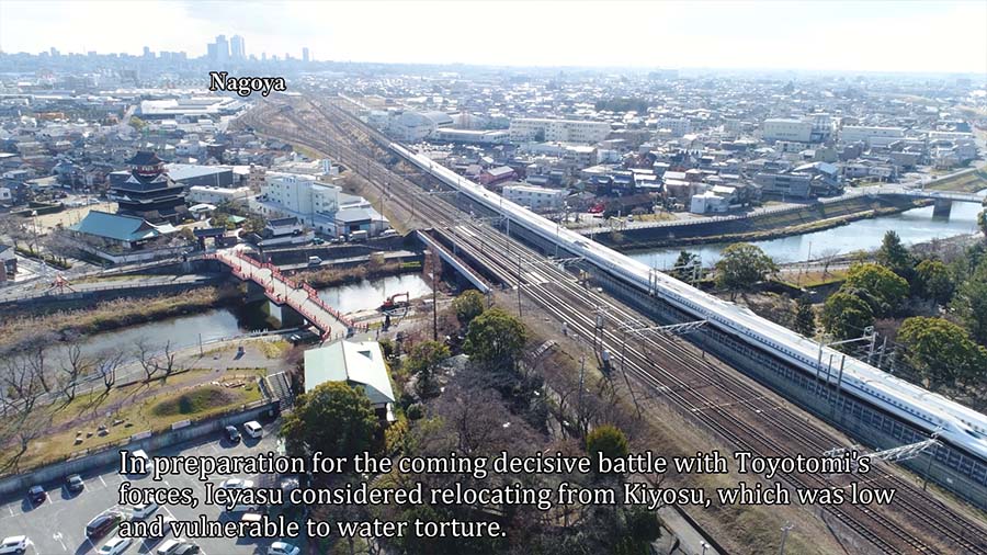
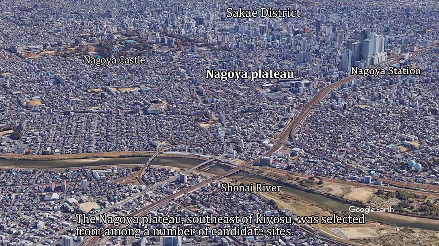
In preparation for the coming decisive battle with Toyotomi's forces, Ieyasu considered relocating from Kiyosu, which was low and vulnerable to water torture.The Nagoya plateau, southeast of Kiyosu, was selected from among a number of candidate sites.The northern end of the Nagoya plateau was a sheer cliff.The Shonai River flowed on the west side, and the Suruga Highway leading to Okazaki, the birthplace of the family, passed on the east side.Off the southern tip of the Nagoya plateau in Atsuta was a shallow beach that refused the intrusion of large vessels.In 1610, construction of Nagoya Castle began.Along with the construction of Nagoya Castle, shrines, temples, and town houses were relocated to Nagoya.It is called "Kiyosu-Goshi."
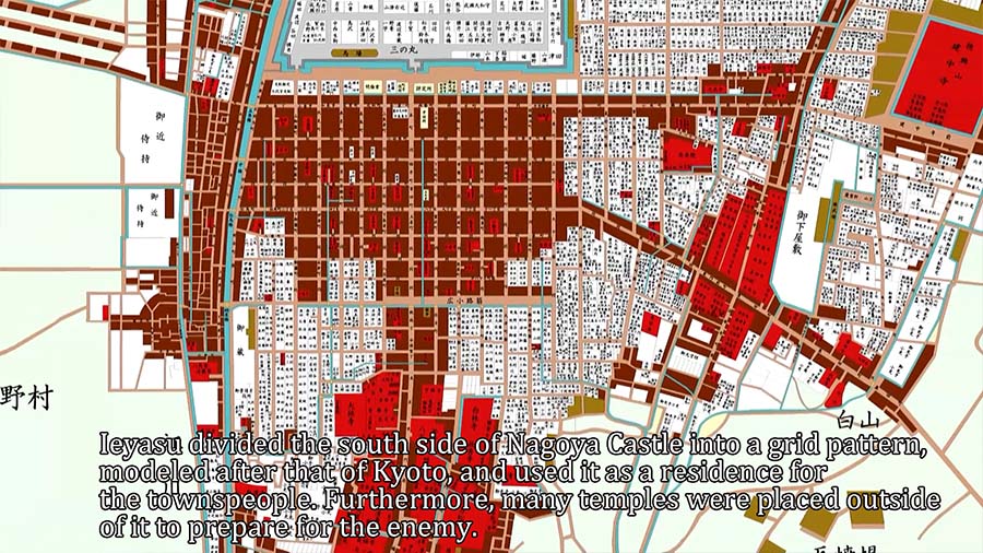
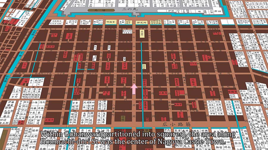
Ieyasu divided the south side of Nagoya Castle into a grid pattern, modeled after that of Kyoto, and used it as a residence for the townspeople.The samurai residences were arranged around blocks divided into ninety-nine sections.Furthermore, many temples were placed outside of it to prepare for the enemy.The prototype of today's central Nagoya, known as Gobanwari, was formed at this time.


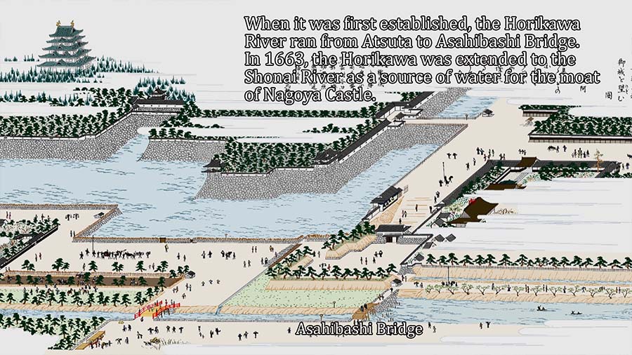
Excavation of the Horikawa River/h5>
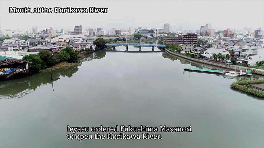
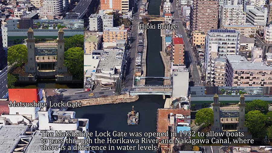
Ieyasu ordered Fukushima Masanori to open the Horikawa River.From downstream, the Oto, Furuwatari, Hioki, Noryabashi, Tenma, Naka, and Gojo bridges were built.They were called the seven bridges of the Horikawa River.
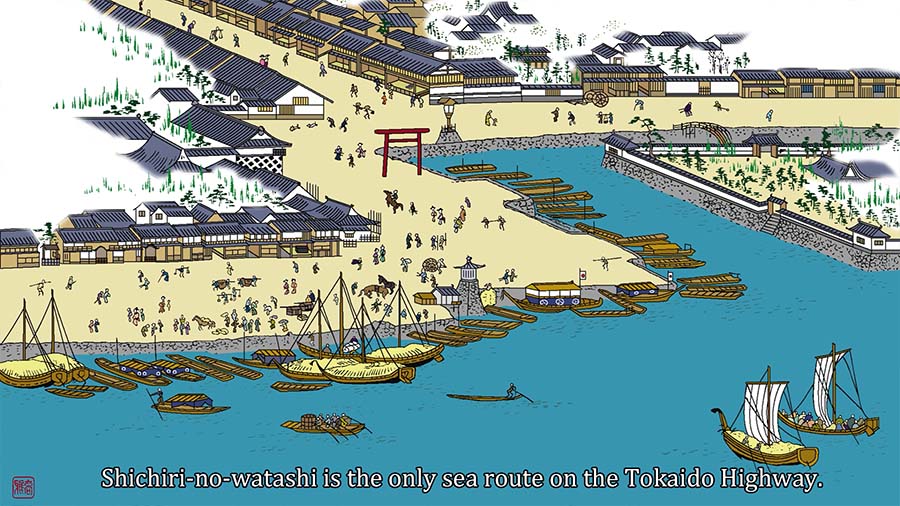
Shichiri-no-watashi is the only sea route on the Tokaido Highway.The beach of Atsuta near the ferry terminal was lined with inns that catered to wealthy merchants and high-class samurai waiting for their boats.A fish market was held by six wholesale dealers designated by the Owari Clan in the area northwest of the Shichiri-no-watashi ferry terminal, in what is now Oseko Park.Shirotori was used as the venue for Cop 10.The Shipyard and a lumberyard were built there.
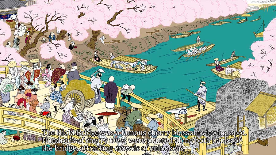
The Sawa Kannon Myoanji Temple south of the Otobashi Bridge was one of the three most scenic spots in Nagoya, with a view of the Suzuka Mountains in the distance.The Otoshibashi Bridge was also called Shinbashi(new bridge) because it was washed away by floods and was frequently replaced.The Hioki Bridge was a famous cherry blossom viewing spot. Hundreds of cherry trees were planted along both banks of the bridge, attracting crowds of onlookers.
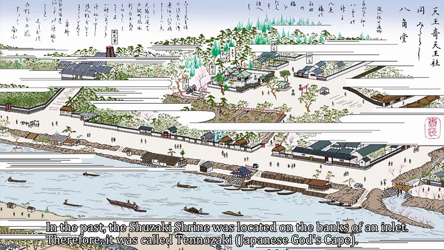
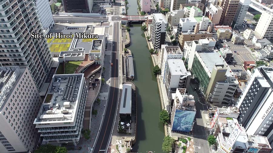
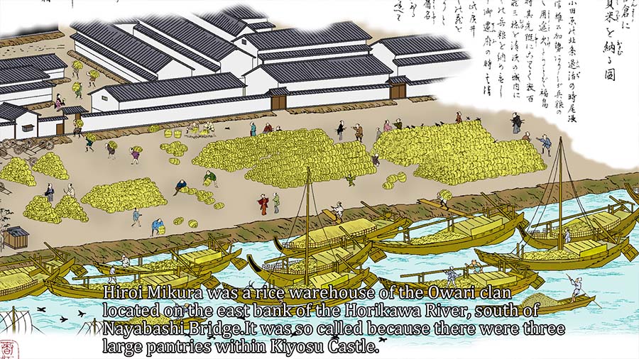
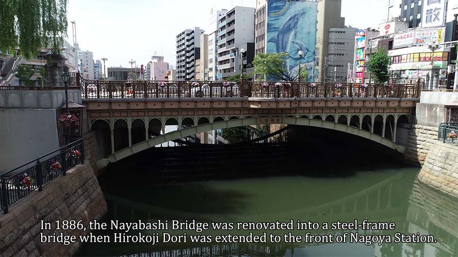
In the past, the Shuzaki Shrine was located on the banks of an inlet. Therefore, it was called Tennozaki (Japanese God's Cape).Hiroi Mikura was a rice warehouse of the Owari clan located on the east bank of the Horikawa River, south of Nayabashi Bridge.It was so called because there were three large pantries within Kiyosu Castle.Lumber merchants gathered on the east bank past the Nayabashi Bridge, and the warehouses of wealthy merchants lined Shikemichi on the west bank of the Horikawa River.
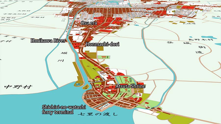


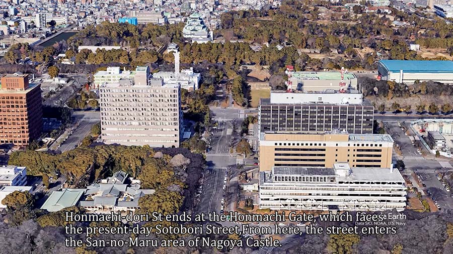
Honmachi-dori street, the main road of Nagoya Castle Town
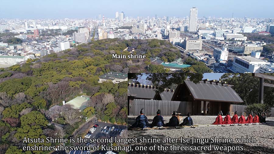
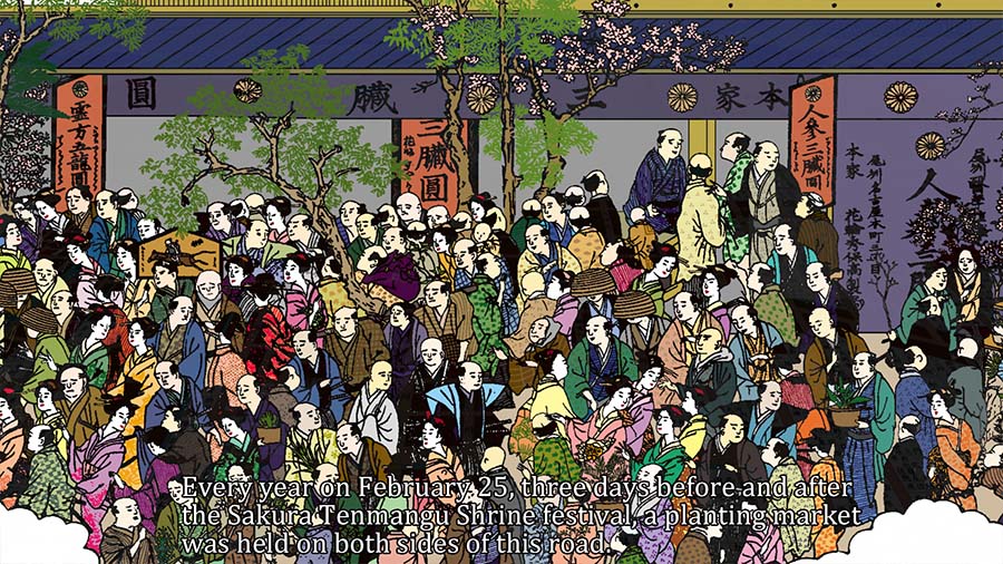
Ieyasu also constructed Honmachi-dori street as a key road connecting the port of Atsuta, a strategic point on the Tokaido Highway, to the Nagoya castle area.Atsuta Shrine is the second largest shrine after Ise Jingu Shrine, which enshrines the sword of Kusanagi, one of the three sacred weapons.Honmachi-dori street ran along the west side of Atsuta Shrine.There were eight torii gates around Atsuta Shrine.The Ichino-torii, or first shrine gate, in Otto, was particularly large and startled passersby.
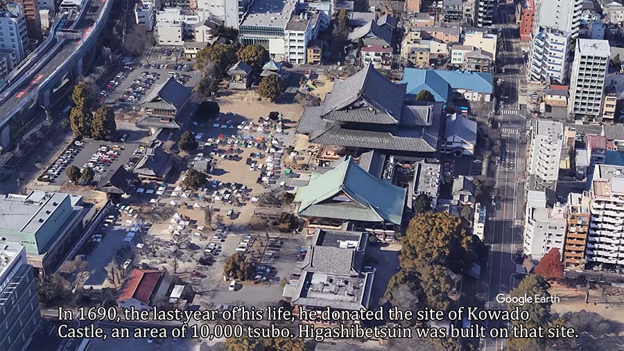
To the north of Furuwatari Village was called Senbon Matsubara and there was an execution site. The second feudal lord, Tokugawa Mitsutomo , relocated the place of execution and named it Tachibana(General term for mandarins)-macho, and built a playhouse, Tachibana-za.In addition, Mitsutomo donated 10,000 tsubo (about 1,000 square meters) of the site of Furuwatari Castle, adjacent to the east of Tachibana-za, to build Higashibesuin Temple.
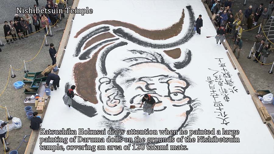
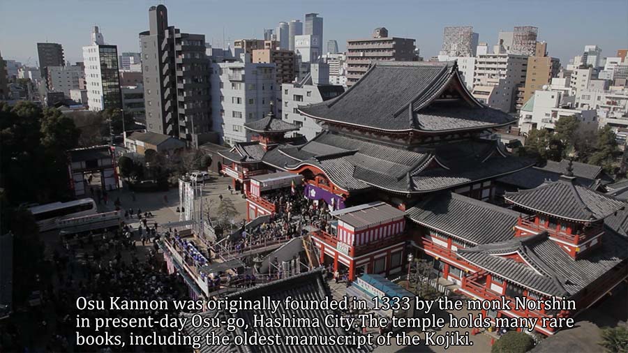
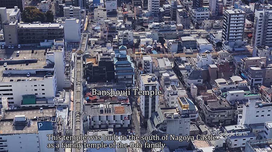
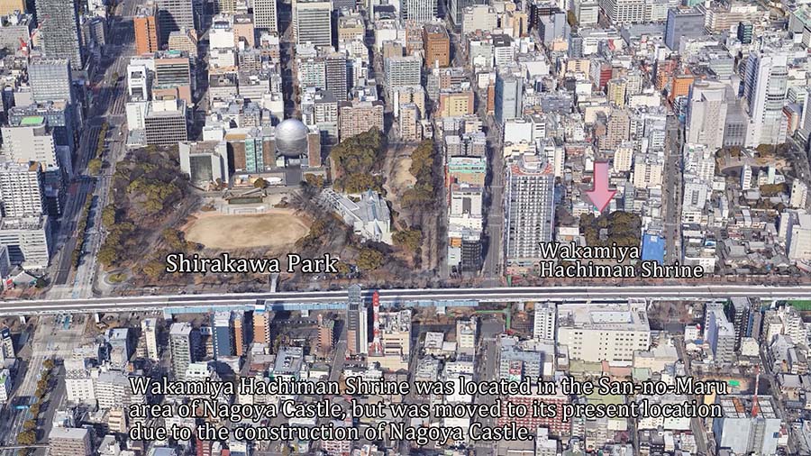
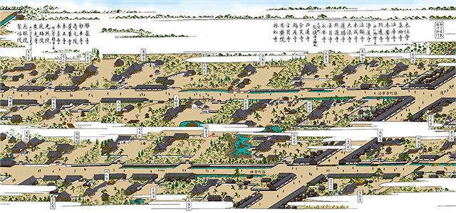
Katsushika Hokusai was a famous ukiyoe artist of the late Edo period. He drew attention when he painted a large painting of Daruma dolls on a 120-tatami mat area in the precincts of Nishibetsuin Temple, facing west on Honmachi Dori.Nanatsudera Temple was located adjacent to the north of Nishi Betsuin Temple, founded in 735 by Gyoki in Kayatsu. It was relocated to Nagoya during the Kiyosu-goshi period.The temple holds many valuable and important cultural properties.Osu Kannon temple was originally founded in 1333 by the monk Noshin in present-day Osu-go, Hashima City.It holds many rare books, including the oldest manuscript of the Kojiki(A history book including Japanese mythology). Banshoji temple was built in 1540 by Oda Nobuhide Oda, father of Oda Nobunaga, on the south side of Nakono Castle as a family temple of the Oda family.It was moved to the present location due to the construction of Nagoya Castle.Continuing north, we come to present-day Shirakawa Park. In this area, temples of various sizes were concentrated and became part of the Minami-teramachi district.
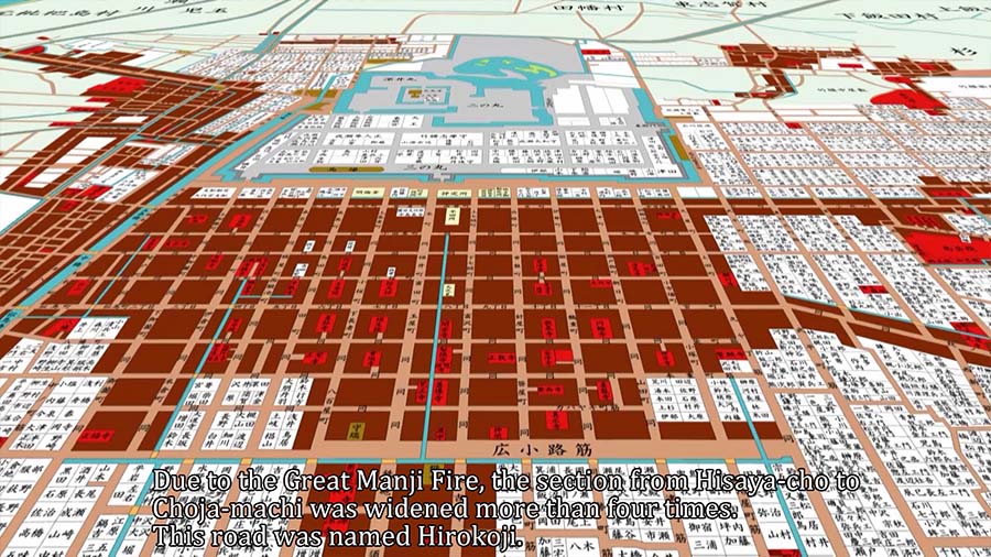
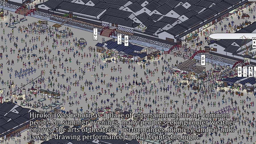
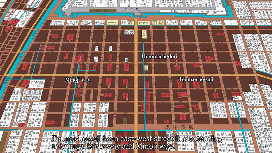
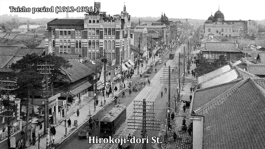
The southern end of Gobanwari is 5.45 m wide andIt was called Horikiri-suji.In 1660, the Great Manji Fire destroyed most of Nagoya Castle Town. To prevent similar fires, the Owari Clan had the section from Hisaya-cho to Choja-machi extended to about 27 meters.This road was called Hirokoji and became a representative road in Nagoya Castle Town.At the junction of Honmachi-dori and Minoji highway, there was a Nagoya post station on Minoji highway.It was the center of the castle town, where the bulletin board and Tenma Kaisho were located.At Tenma Kaisho, official human and horse intermediation took place.


Higashi-tera-machi
Going east on Tenmachi-suji, it connects to Suruga Kaido highway. Small and medium temples lined both sides of Zendera-cho Suji and Hokkeji-cho Suji, which intersected Suruga Kaido highway.It was called Higashi-tera-machi and was responsible for defending the east. Suruga-kaido highway led to Okazaki, the birthplace of Tokugawa Ieyasu.
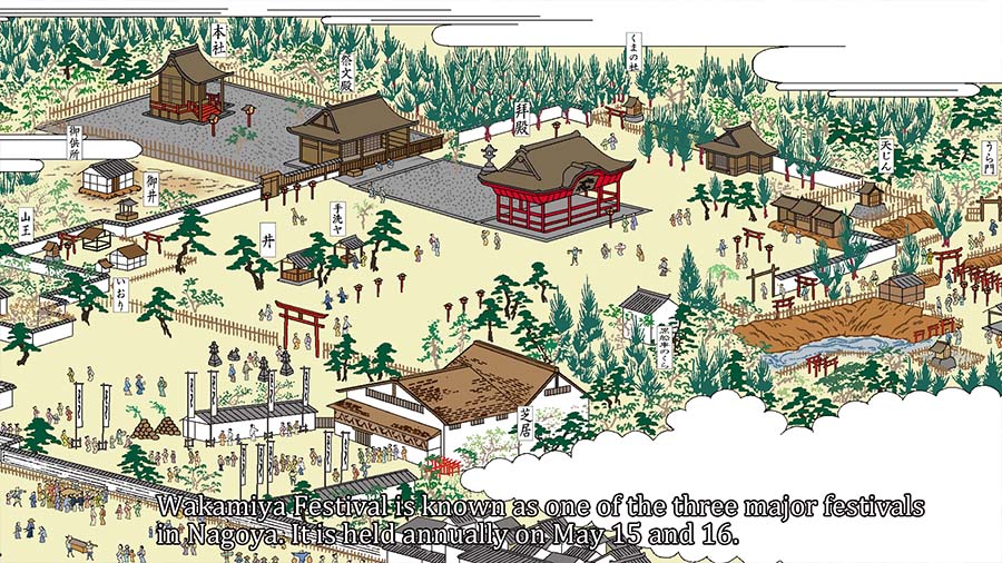
Nagoya Toshogu Shrine Festival
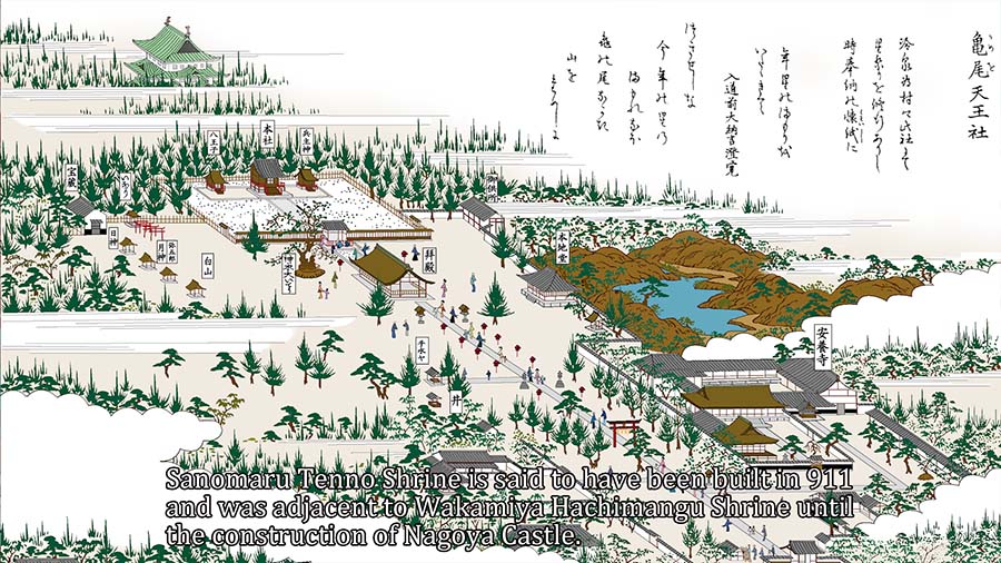
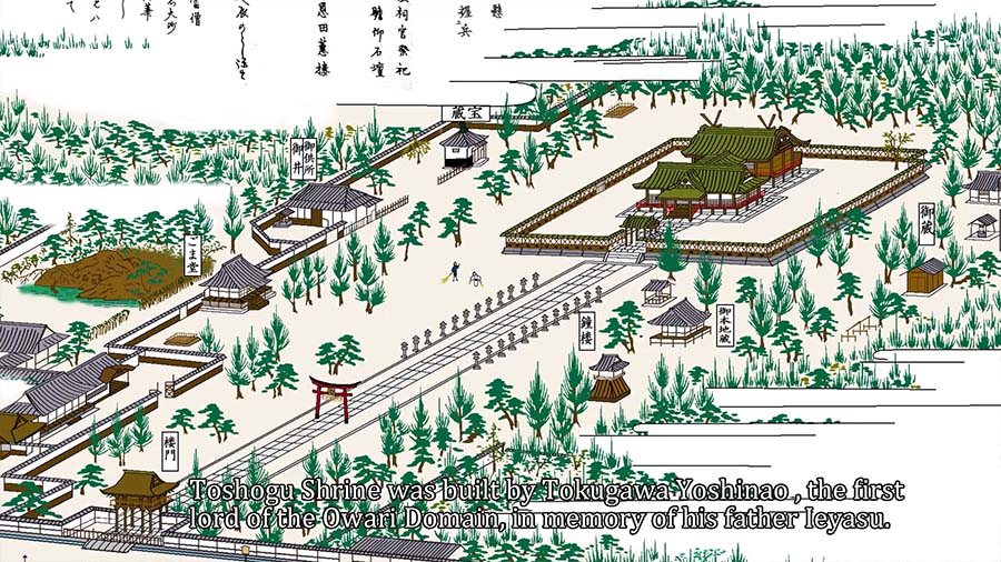
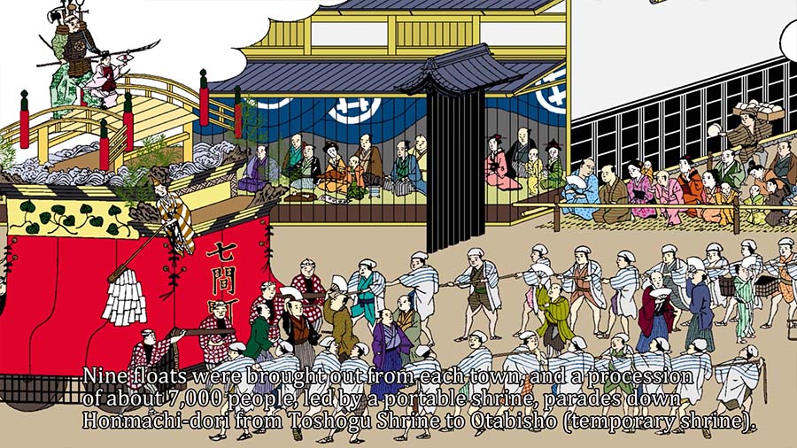
The Sanomaru Tenno Shrine and the Toshogu Shrine stood side by side in the Sanomaru area of Nagoya Castle.The Toshogu Festival has been held annually on April 17.Nine floats were brought out from each town, and a procession of about 7,000 people, led by a portable shrine, parades down Honmachi-dori from Toshogu Shrine to Otabisho (temporary shrine). The streets along Honmachi Dori were crowded with spectators.The Toshogu Festival procession was held until the early Showa period (1926-1989), and was called the Nagoya Festival. It was the largest festival in Nagoya and was well known by the citizens of Nagoya.The gate, a national treasure, shrine pavilions and floats were destroyed by fire in an air raid in 1945.The Toshogu Festival procession was cancelled.


Collapse of the Tokugawa Shogunate and establishment of the Meiji Government
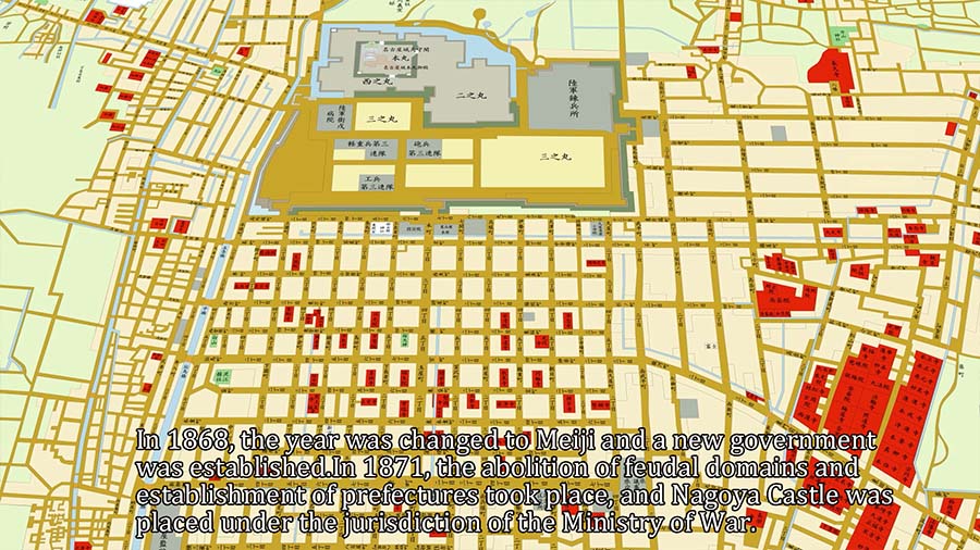
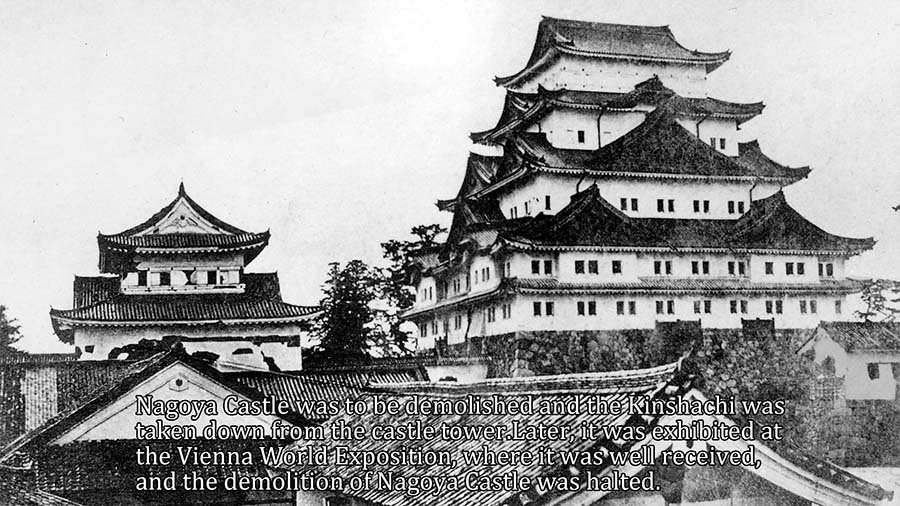
In 1868, the year was changed to Meiji and a new government was established. In 1871, the abolition of feudal domains and establishment of prefectures took place, and Nagoya Castle was placed under the jurisdiction of the Ministry of War.Nagoya Castle was to be demolished and the Kinshachi was taken down from the castle tower.Later, it was exhibited at the Vienna World Exposition, where it was well received, and the demolition of Nagoya Castle was halted.In 1873, Nagoya Chindai(garrison) was established in San-no-Maru, Nagoya Castle.Later, in 1888, it was reorganized into the 3rd Division.
History of Nagoya City Hall and Aichi Prefectural Government
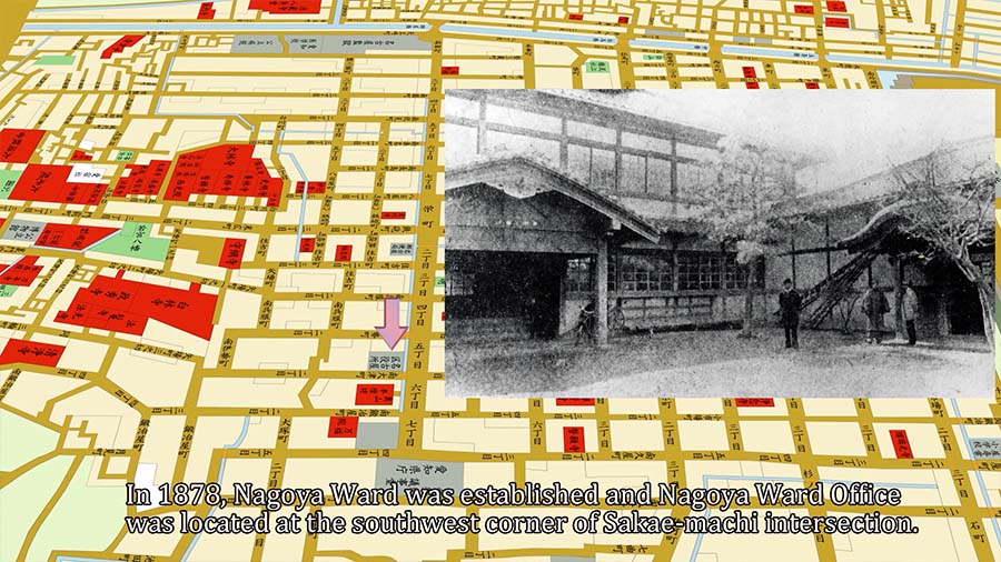
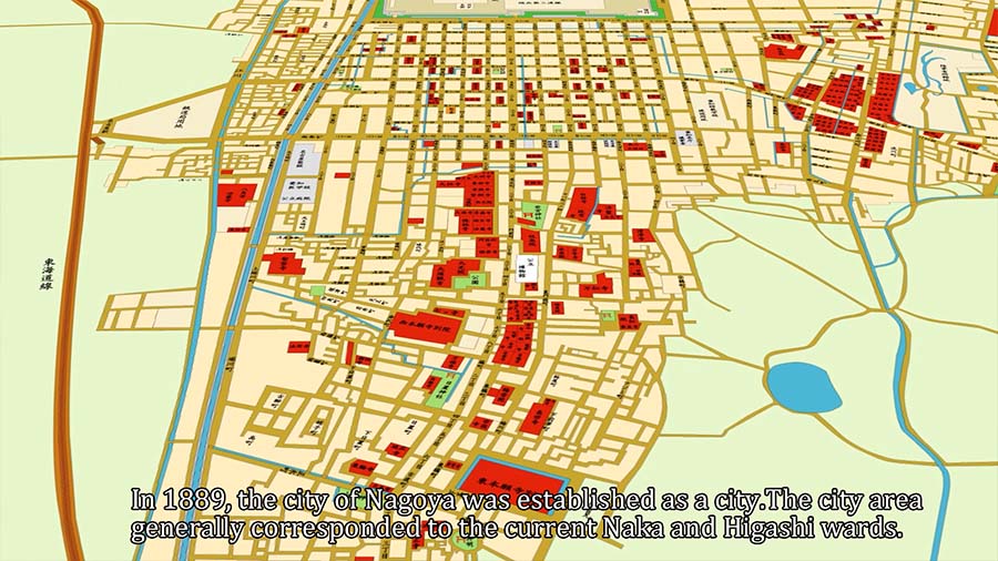
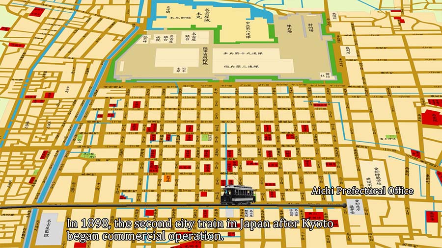
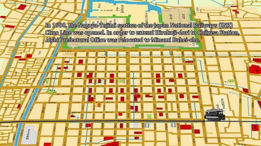
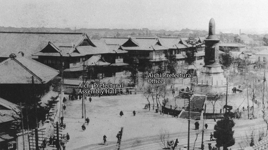
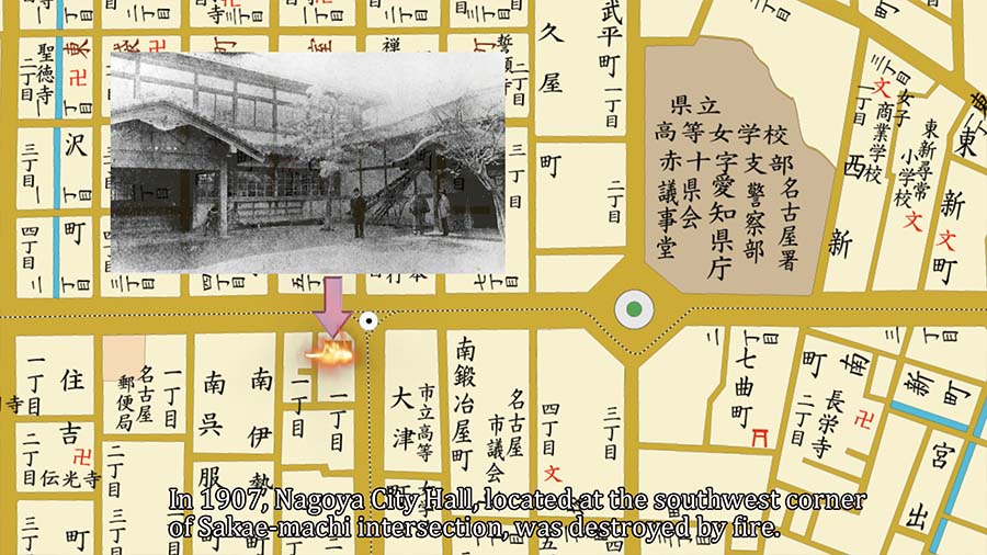
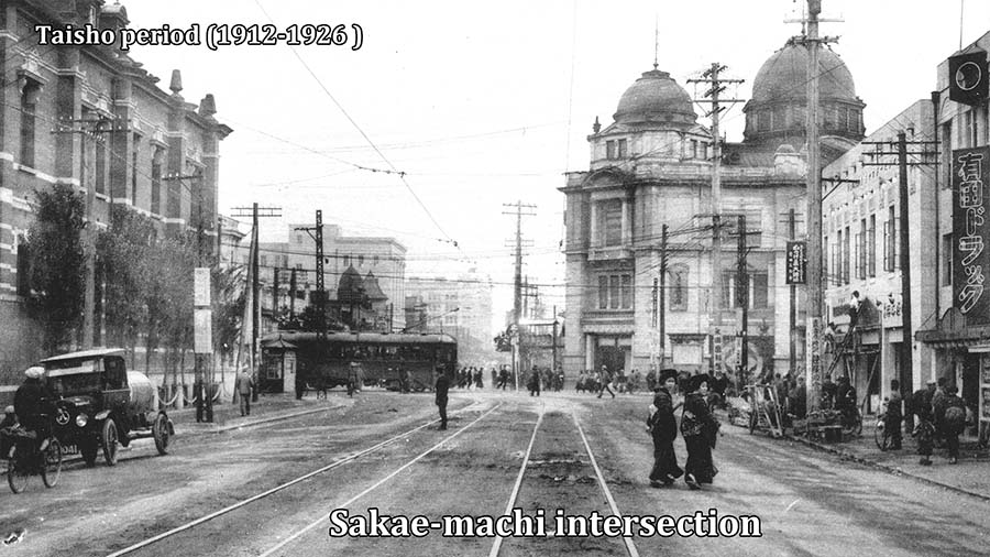
In December 1878, the Gun-ku-cho-son Henseiho (an act for the organization of the administrative divisions) was implemented. The administrative district of Nagoya was created, and Nagoya Ward Office was established at the southwest corner of the Sakae-machi intersection.In 1889, the Ward Office Building became the City Hall Building when the city was incorporated.In 1907, a fire broke out and the building was destroyed by fire, and was relocated to the current location of Naka Ward Office.At the beginning of the Meiji Restoration, Aichi Prefectural Office was located in San-no-maru, Nagoya Castle, but due to the construction of Nagoya Chindai, Higashi Betsuin was used as a temporary building.In 1877, a new government building was constructed at the end of Hirokoji Street.In 1898, the nation's second local train, after Kyoto, began operating between Nagoya Station and the prefectural government office.In 1900, the Chuo Line between Nagoya and Tajimi was opened. To extend Hirokoji-dori to Chikusa Station.Aichi Prefectural Office was relocated again to Minami Buhei-cho.
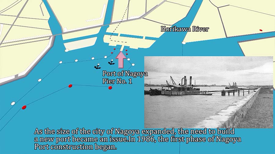
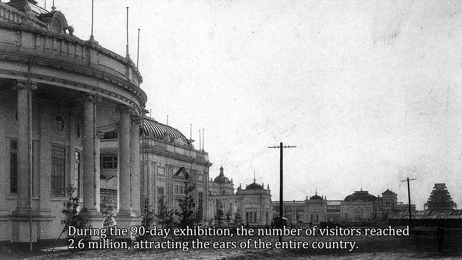
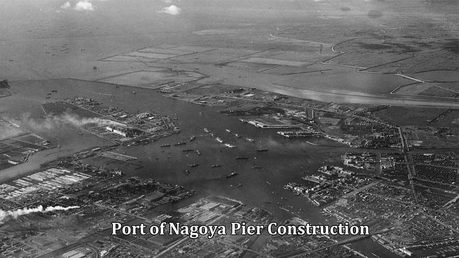
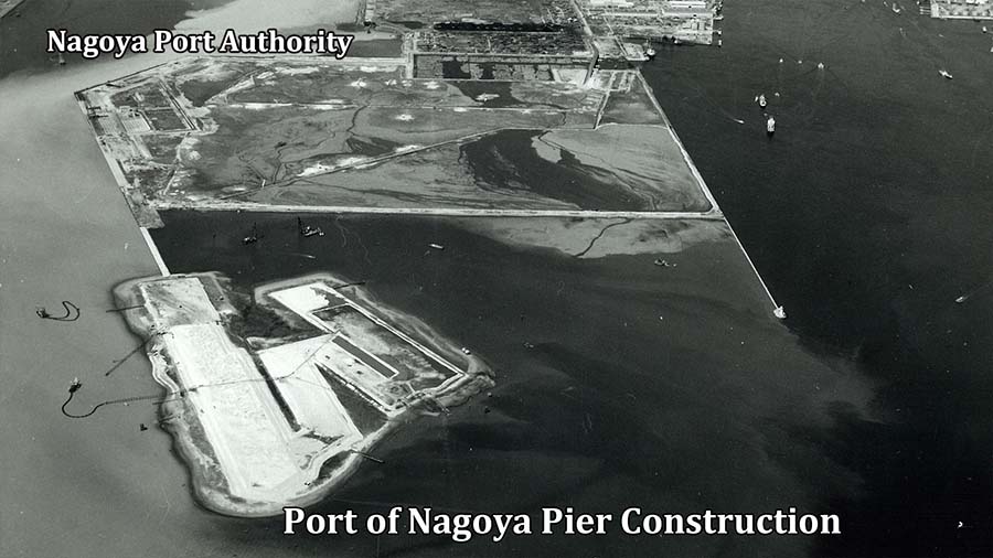
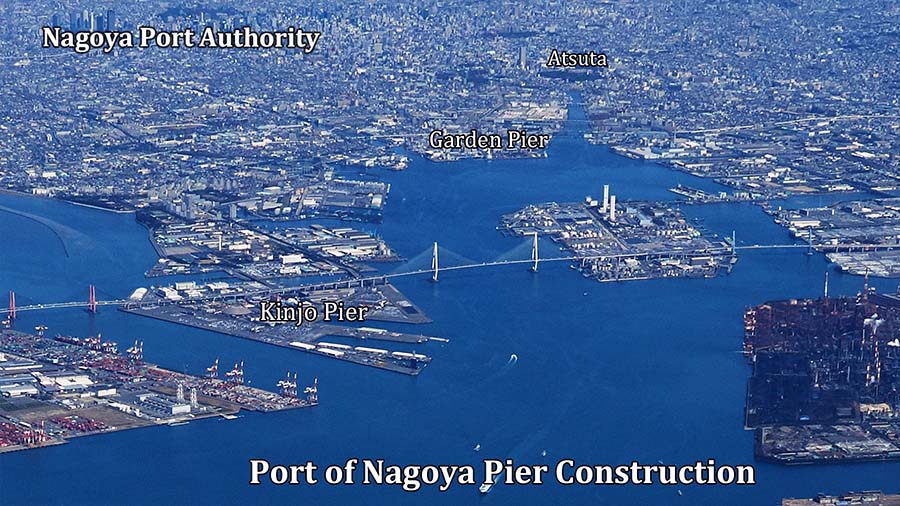
Opening of the Port of Nagoya
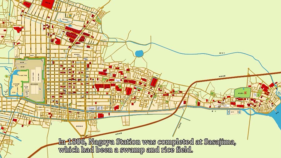
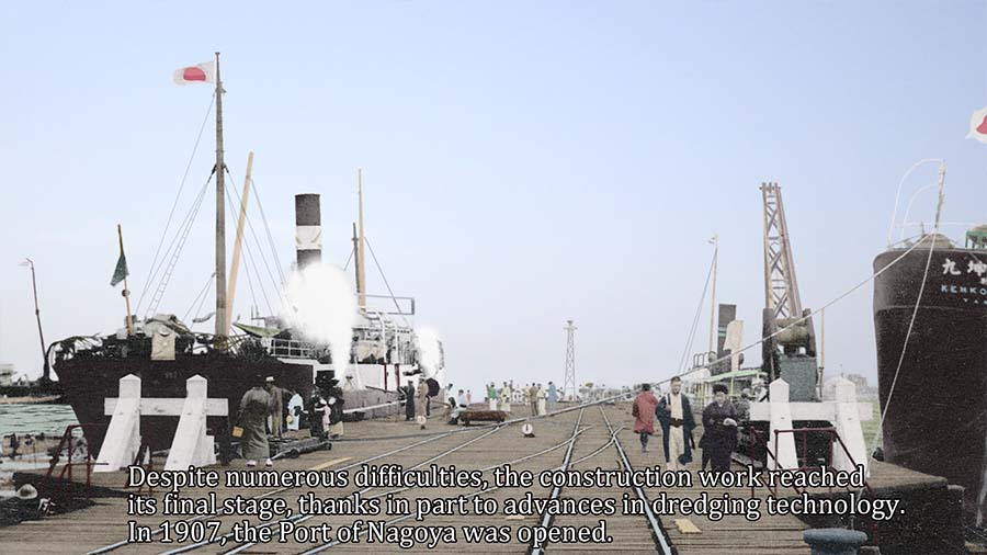
The offshore of Atsuta Port was shallow. This was a major factor preventing large vessels from entering the port.As the size of the city of Nagoya expanded, the need to build a new port became an issue.In 1986, the first phase of Nagoya Port construction began.Despite numerous difficulties, the construction work reached its final stage, thanks in part to advances in dredging technology. In 1907, the Port of Nagoya was opened.


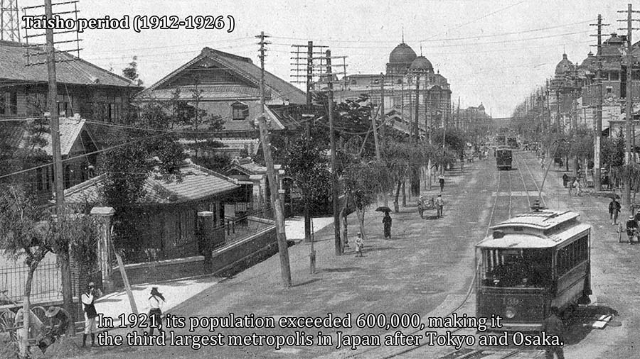
Taisho Era(1912-1926)
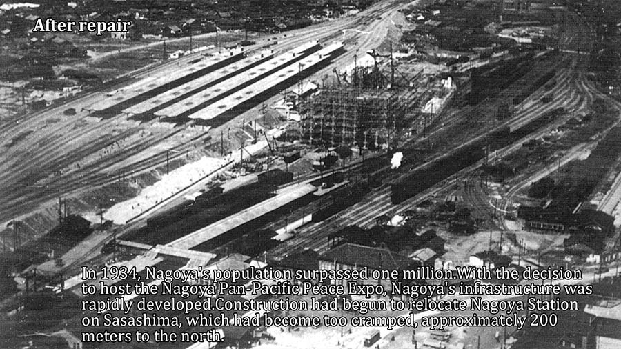
In 1914, World War I broke out. Japan entered the war at the request of the British government under the Anglo-Japanese Alliance and became a member of the victorious nation. Japan seized the opportunity to shift its industrial structure from light to heavy industry.In Nagoya, the construction of five major highways, including the Meido, Takaoka, Chihaya, Otsumachi, and Iwai lines, began and was completed in 1924.The construction of five major arterial roads began and was completed in 1924.In 1921, 16 towns and villages were incorporated into Nagoya City. With an area twice the size of Tokyo and a population exceeding 600,000, Nagoya became the third largest city in Japan after Tokyo and Osaka.


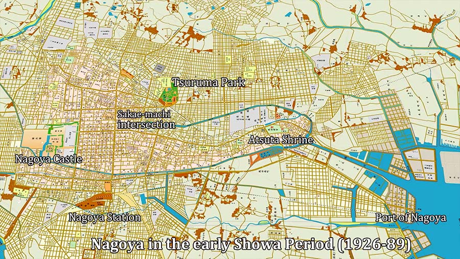
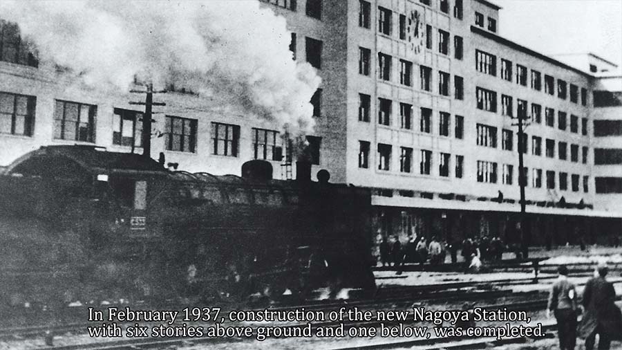
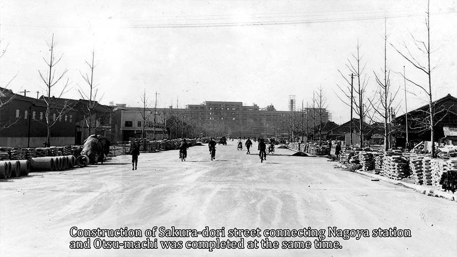
Nagoya in the early Showa Period (1926-89)
Emperor Taisho passed away and the year was changed to Showa.Celebrations were held in various places to mark the Emperor's accession to the throne, and a triumphal arch was built in Hirokoji Honmachi.In 1929, in preparation for the Emperor Showa's visit to Nagoya, Honmachi-dori was developed.Paving and widening work was carried out, and the street came to be known as Miyuki-honmachi.
In 1933, Nagoya City Hall was moved from Buheicho to its current location. The new government building was completed in the imperial crown style with a 53-meter-high central tower.The Aichi Prefectural Government Building was also relocated and built in 1938 to the south of the City Hall.Both buildings are now designated as National Important Cultural Properties.
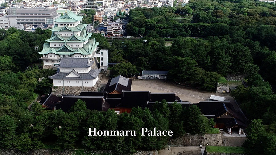
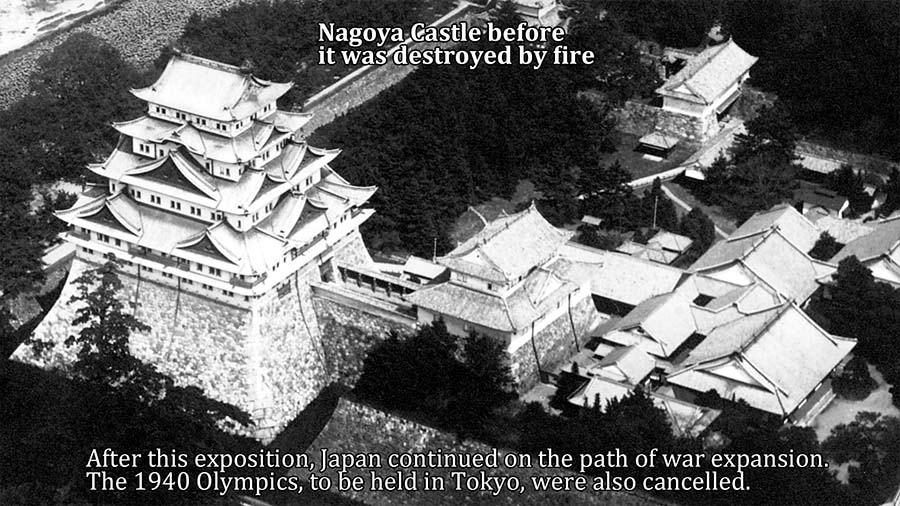
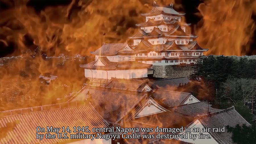
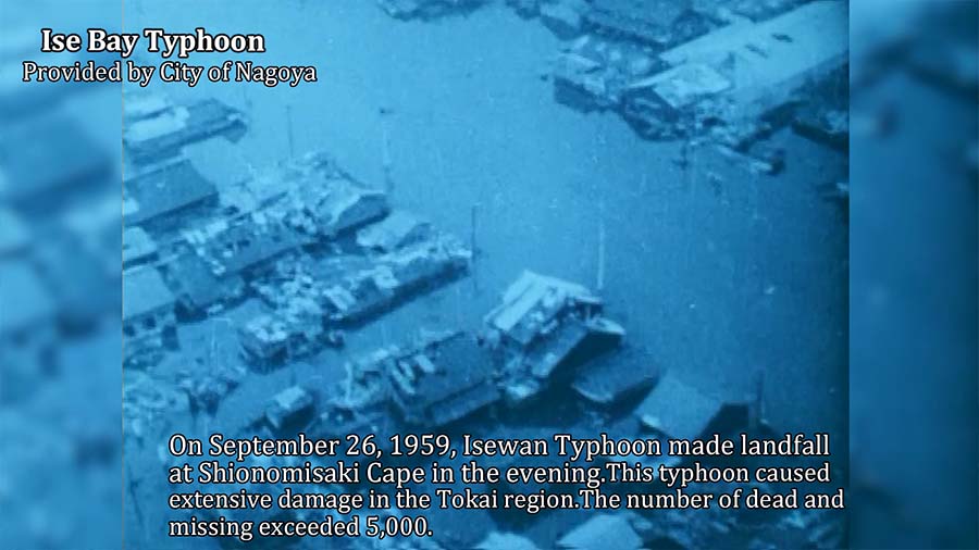
After the government offices were relocated to San-no-maru, the area along Hirokoji-dori became a center of entertainment and finance. Meiji Life Insurance, Nagoya Branch of Bank of Japan, Nippon Life Insurance, Nomura Bank, and Murase Bank, Nagoya branch of the Bank of Japan, Nippon Life Insurance, Nomura Bank, Murase Bank, Aikoku Seimei, Mitsubishi Bank, Mitsui Bank, Yamaguchi Bank, Daiichi Bank, etc., and commercial facilities such as Sakaeya, Maruzen, Fukokukan, Nagoya Takarazuka Theater, Asahi Kaikan, etc.In 1941, the Pacific War broke out, and in 1945, the city of Nagoya was repeatedly bombed, and on May 14, Nagoya Castle and Honmaru Palace were destroyed by fire in an air raid.


Postwar Nagoya and Reconstruction
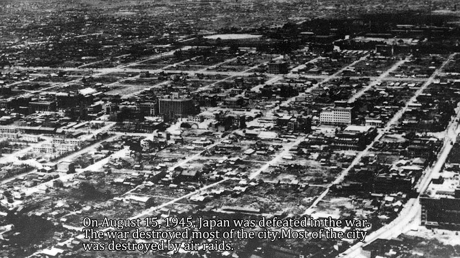
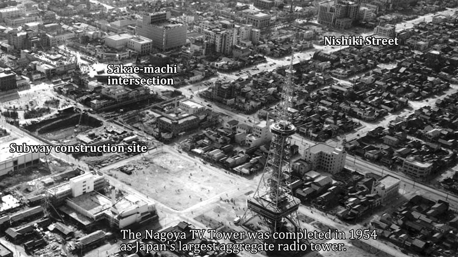
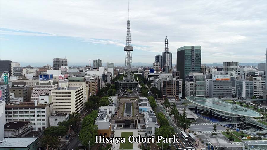
More than half of central Nagoya was destroyed by air raids, and a black market was opened in the burnt ruins. At the same time, reconstruction work began.Two 100-meter roads, Hisaya-odori and Wakamiya-odori, were constructed, and the median strip was developed into a park.The Nagoya TV Tower, Japan's first concentrated radio tower, was completed in Hisaya-odori Park in June 1954. Subway construction also began, and in November 1957, Line 1 (now the Higashiyama Line) between Nagoya and Sakae-cho opened.
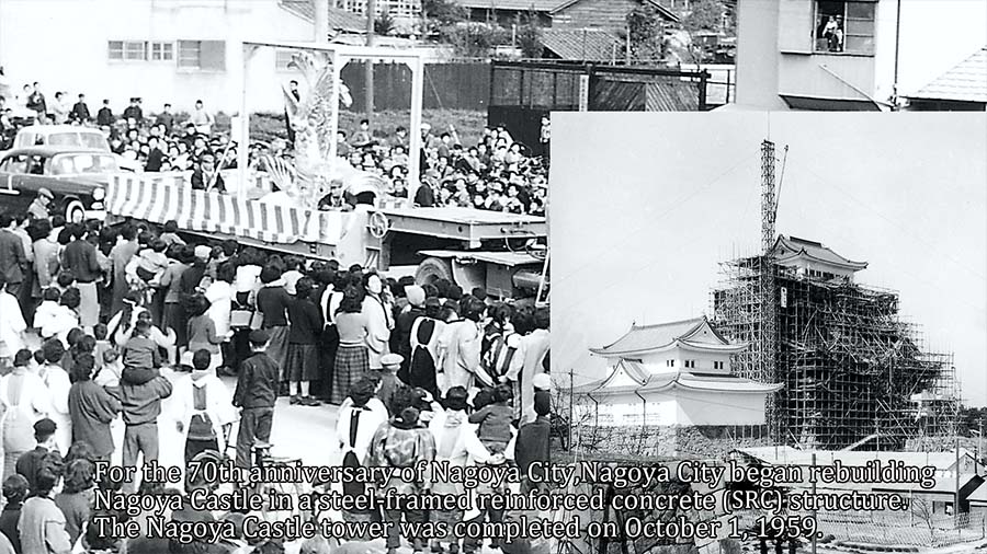
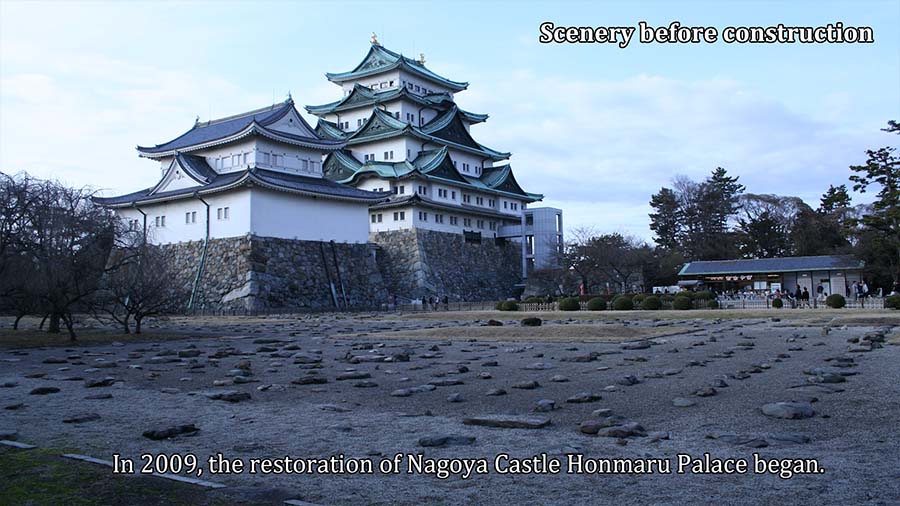
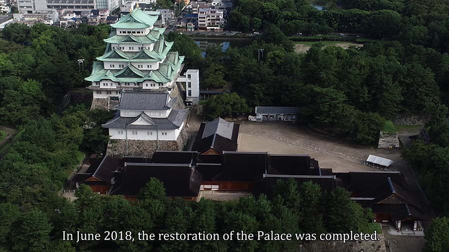
The reconstruction of Nagoya Castle, which was destroyed by fire in World War II, was the wish of the citizens.In 1959, as a commemorative project for the 70th anniversary of the city government, the main and minor keep and main gate were rebuilt in steel-reinforced concrete.In 2009, the restoration and maintenance of the Honmaru Palace began, and was completed and opened to the public in 2018.


The Future of Nagoya
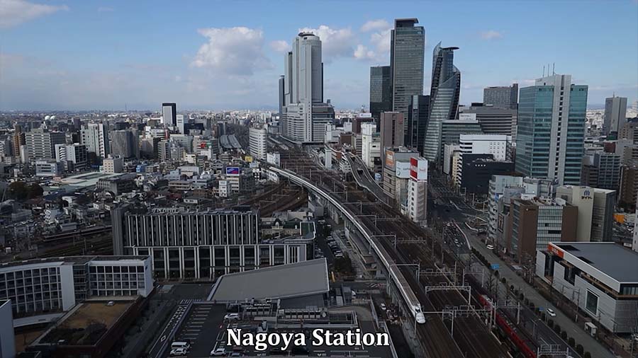
The Super Mega Region Concept is a plan to create a world-leading megalopolis that attracts people, goods, money, and information from all over the world by connecting the three metropolitan areas of Tokyo, Chubu, and Kansai in approximately one hour with the opening of the Linear Chuo Shinkansen. Various infrastructure improvements are currently underway in Nagoya City in preparation for the opening of the Linear Chuo Shinkansen.The City of Nagoya is seeking to create an urban center that is suitable for the core city of the Nagoya metropolitan area and that demonstrates a high level of international competitiveness, with the Nagoya Station area and the Sakae area as the two core areas of the city center.